Recent Media

20th Annual Sierra Challenge, Ten Peaks in Ten Days
20th Annual Sierra Challenge, Ten Peaks in Ten Days
By: Bob Burd
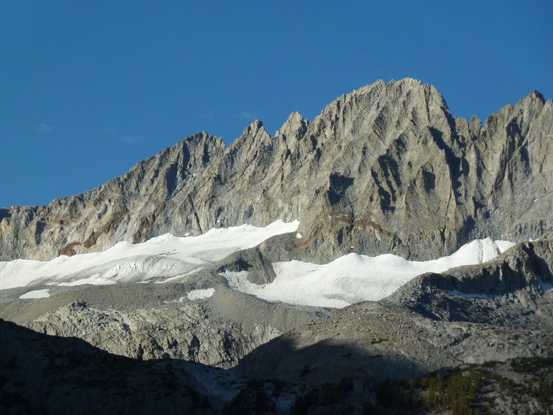
Volcanic Ridge East — Peak 10,213ft
Fri, Aug 7, 2020
Day 1 of the Sierra Challenge
The 20th edition of the Sierra Challenge was ready to begin. It was going to be unusual in its entirety thanks to COVID and the adjustments necessary to do this safely, or at least not unsafely. Luckily, outdoor events have been shown to be far less problematic than indoor ones, but that didn’t mean we had nothing to worry about it. Added precautions included canceling our cook-off, no group photos at start, no large group starts, and the usual mask/social distancing guidelines. For the most part this worked pretty well, but we had our lapses. I was unsuccessful in getting folks to alter their start times to help spread us out – we’re social creatures and most folks wanted to start at the designated time with everyone else. On the trail, I would put on my mask when we passed other groups since it wasn’t always possible to get six feet away, but this was no adhered to universally. Overall, I’d say we did as well or better than the other trail users we came across, and since I had no desire to actually police our COVID policies, I’ll take that as a win.
Today’s goal was on the easy side, about six miles each way with 3,500ft of gain. Volcanic Ridge separates the Shadow Creek and Minaret Creek drainages, found east of the Minarets and the Ritter Range. We had been to the western summit during the 2010 Challenge and I probably should have done the east summit at the same time, but was discouraged by the large drop between them. And though they’re little more than a mile apart, others today would find that doing both together was not trivial. The parking lot at Agnew Meadows was filled to capacity by 5a. That left most of the participants scrambling to find additional parking along the roadway. I had driven in the night before to spend the night, so was ideally situated for the morning start. I got started just before 6a and sunrise with the larger share of the group, some having started earlier, others still looking for a parking spot. The hike starts off with a gentle decline as it makes its way down to the San Joaquin River at the trail junction for Shadow Lake. After crossing the river on a nice bridge, the Shadow Lake Trail begins climbing in short, steep switchbacks to Shadow Lake. I reached the lake with a few others, took the requisite photos including one of Volcanic Ridge East, then continued on the trail around the east side of the lake. Half a mile past the lake we reached the second trail junction with JMT, and folks began to hesitate, knowing we needed to leave the trail somewhere around here. Five of us were soon heading cross-country, looking for a way across Shadow Creek. There was no clear way to get across with our boots on, so we ended up taking them off and wading across at a shallow bend.
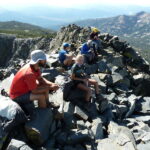
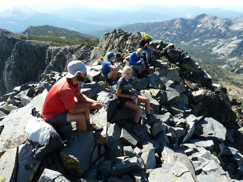
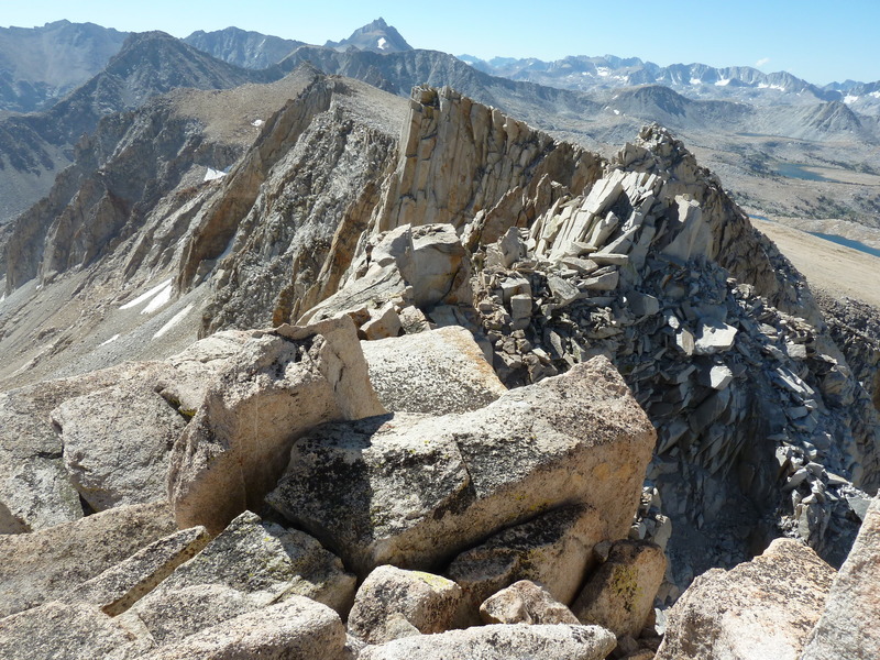
Once on the other side, the going gets steep quickly as we headed up slopes leading pretty directly towards the summit. I was out in front keeping a strong pace, while the other, initially doing a good job of following, dropped back one by one until I was on my own. Once above the forest, I had a clear view of the summit to the south, eyeing what looked like a neat chute going directly up to a notch just west of the highpoint. The chute was partly filled with snow and probably too hard to get up without axe or crampons, so I aimed to the right for what would pass as the NW Ridge. There was some nice class 3 scrambling along this, though most of it was class 2. I spied a pair of climbers ahead of me that turned out to be the Shaper brothers. I caught up with Andrew before reaching the notch, but David kept a strong pace and would beat me to the summit. The summit looks tough from a distance. Cliffs surround it on three sides, but by fortunate happenstance, there is a class 3 chute on the southwest side just past the notch that could get us to the summit without too much trouble. David Quatro was already at the summit with the other David, and it appears Fred Zalokar, a new participant, had already been to the summit and left. We eventually collected nine at the top over the next 20min as we rested up and enjoyed the fine views across the Ritter Range in a panoramic view stretching south to west.
The obvious bonus peak was Volcanic Ridge West about a mile in that direction, but having already visited it I was more interested in unnamed Peak 10,213ft, a little further to the southwest. It seemed no one else shared my interest, so I packed up to start back down by myself. I met Mason just below the summit, pausing as he told a humorous tale of others who had tried to follow him across a difficult route from the west. They would eventually find their way around the difficulty, but I would be gone by then. I descended a wide gully on the south side of the ridgeline, just below the notch we had crossed earlier. It was loose talus and sand, and though it did not have a quick boot-ski descent line, it went quickly enough to get me down in about 20min. The gradient eased as I began a lovely cross-country trek down this isolated drainage that would eventually connect with the Minaret Creek Trail. I kept to the right (west) side of the drainage in order to skirt the base of a subsidiary ridge of Volcanic Ridge West, traversing into the next minor drainage west where I could then climb up to Peak 10,213ft. I was happy to find that this worked quite nicely, better than I had expected. Once I’d crossed the shallow drainage, the ascent up the NE Ridge proved enjoyable class 2-3 scrambling to a rocky summit with a stunning view of the Minarets to the southwest. It took only an hour and twenty minutes to get between the two summits, and as it was only 11:10a, I had much of the day still ahead.
My plan had been to descend to the Minaret Trail and follow that down to the JMT which could then be followed back to Shadow lake. With so much of the day remaining, I decided on the more scenic return around the west side of Volcanic Ridge, a route I hadn’t used in more than a decade. I descended off the north side of Peak 10,213ft into a green meadow where a large party of about 10 were camped above Minaret Lake. Six of them were relaxing in camp chairs arranged in a straight line as though watching a sporting event at the polo grounds. They asked me how the climb was, but didn’t seem much inclined to leave their comfortable positions even after my glowing review. I continued west down to Minaret Lake where I picked up the trail leading up towards Cecile Lake. I had forgotten that the trail ends before reaching the lake and doesn’t start again until beginning the descent to Iceberg Lake, leaving a 30min stretch of boulders and talus to negotiate. With the stunning surroundings, I didn’t mind this as much as I might have in a different location. As I was going by Cecile Lake I noted that it appeared I had it entirely to myself, and decided on a whim to stop for swim. The water was quite refreshing, though I didn’t stay in it for more than a minute. The use trail that’s developed between Cecile and Iceberg Lakes is pretty crappy to start but gets better, becoming a regular trail before it passes by the outlet of the lower lake. I stopped here for a second swim, my small effort to compete in the Aqua Jersey. On my way down to Ediza Lake, I stopped just past its outlet when I spotted a couple of familiar faces. My brother Jim, looking like John Muir these days with a huge, bushy white beard, was joined by Evan Rasmussen and his brother. They had been fishing the lake for maybe an hour with no success, but they’d done better earlier in Shadow Creek and didn’t seem to mind the current lack of action. After about 10min I gathered myself up and continued down the trail.
It would take me another two hours and change to find my way back to the parking lot at Agnew Meadows, finishing up by 3:30p. I saw plenty of folks on the trail between Ediza Lake and the TH, but oddly no other Challenge participants. Most of them had gotten back before me and I found a few in the parking lot, including Tom and Iris who’d made it back 15min earlier. After returning to Mammoth Lakes, I got a few supplies in town before heading off to McGee Creek where I would spend the night with a handful of other participants, likewise sleeping in their vehicles.
Fred had gotten back in 4h25m, hours before anyone else. Granted, he had only gone to the Challenge peak and returned, but it was still less than half the time I spent on the trail. With similar performances over the next few days, Fred would establish an insurmountable lead right from the start, the only question being, would he be able to finish the ten days? In a similarly commanding fashion, Grant would visit seven summits on the first day to establish a lead in the King of the Mountain Jersey that he would never relinquish. His summits included Clyde and Eichorn Minarets, no easy bonus peaks by any measure. He was the last to return to the TH, having spent almost 14hrs on the go.
Scheelore Peak — Peak 11,899ft
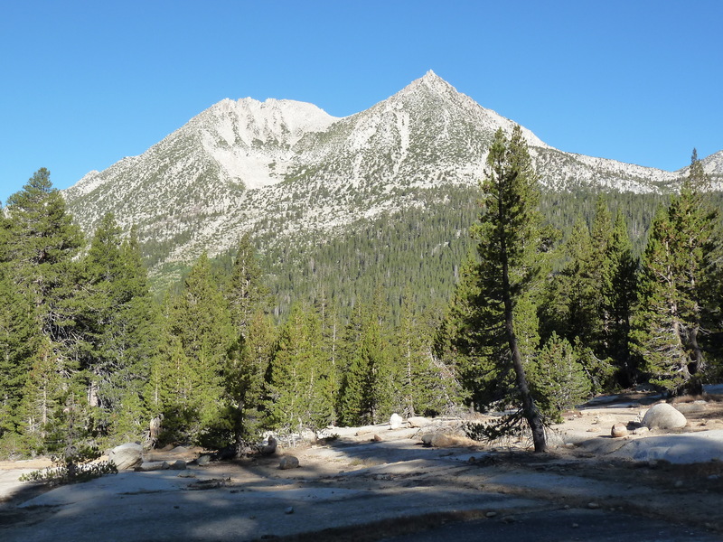
Mt. Baldwin — Peak 12,388ft
Sat, Aug 8, 2020
Day 2 of the Sierra Challenge
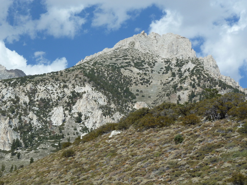
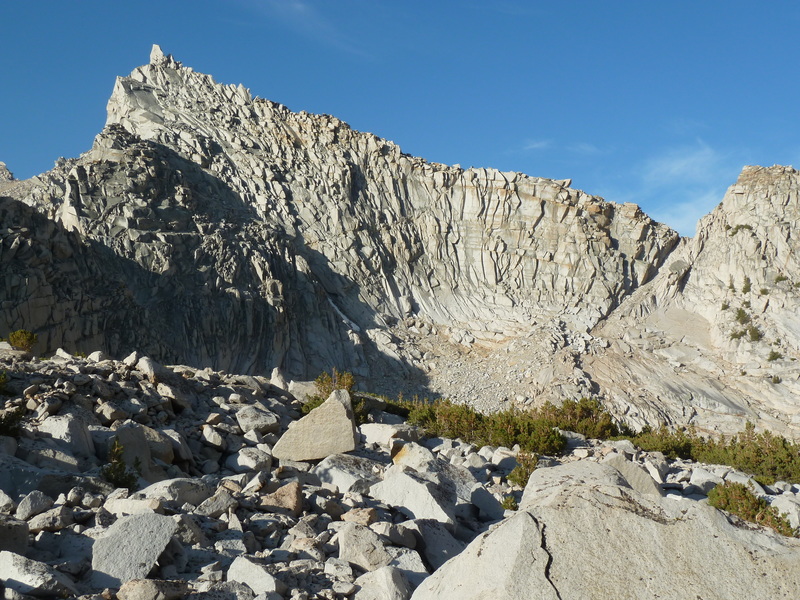
Day 2 of the Sierra Challenge had us visiting unofficially named Scheelore Peak in the Mammoth Lakes area, less than a mile south of Mt. Baldwin. Our starting point at McGree Creek has been used by the Sierra Challenge a number of times over the years, most recently in 2018 for McGee Pass Peak. Our route would take us up past the Scheelore Mine on a section of trail I’d never traveled on the east side of the Baldwin Crest. In addition to the Challenge Peak, there were two unnamed summits that I was interested in, rounding out the last of the peaks around Baldwin that I’d yet to visit.
A group of around 10 started off from the parking lot by 6a, just before sunrise. We soon entered the John Muir Wilderness, making our way up the trail with the familiar array of peak on the right side of the canyon – McGee, Aggie, White Fang, Baldwin. The rocks take on colorful hues from chalk white and grays to orange and brown. On paper it would seem a shorter route might be found going cross-country upslope where the trail turns to the south. Grant and Clement paused to consider just this. Grant would end up taking a route directly up to Mt. Aggie, then onto White Fang and Baldwin. Clement chose to stay with the pack on the planned route. Further upstream, logs had been laid across the creek to make the crossing fairly tame. We passed by a few folks still asleep in their tent as we continued further through forest. At the first trail junction we turned right to begin the gradual climb up to Scheelore Mine. The trail doesn’t get a lot of use and is hard to find in a few places, but for the most part it was in decent shape. At one time it was a road used to get supplies up to the mine, which is still evident in many places. After meandering to get through the forested areas, the trail/road breaks out into more open terrain where Scheelore Peak first comes into view. Cliff bands and steep slopes suggest it will not be a trivial ascent.
While most of our party collected at the unnamed lake below the mine to fetch water and take a short break, I turned off the road to start making my way up the SW Slopes of Peak 11,899ft. It was a somewhat tedious ascent up talus and broken rock, taking about 25min to reach the top. I would periodically look back to see if anyone was behind, but it seemed no one shared my enthusiasm for this not-so-great summit. It did offer nice views, not only of McGee Canyon to the northeast, but also the other two summits, Peak 12,388ft to the southwest and Scheelore Peak immediately west across the drainage. It was not clear just how we might be able to reach Scheelore Peak with cliffs dominating the upper half of the mountain. A red band of rock starting above the talus slope and ascending diagonally to the left seemed to offer one possibility. I noted the string of participants north of the lake heading in that direction as I started off Peak 11,899ft. I made a descending traverse towards the mine to save some elevation loss. I could see the others make a cursory examination of the mine ruins before starting up the talus slope towards the red band, and they were all well ahead by the time I reached the road and the mineworks at its end.
Once I’d ascended the talus slope, I started to scramble the class 3 slabs on my left to shortcut the route taken by the others who first went to the saddle above before turning left. Mine wasn’t the best choice, as I found a small handful of rocks coming down the face, alarming fast since there was little to slow them down. One of these was baseball-sized and I started to think that perhaps not all above me were being careful. I reached the red band about the same time that three climbers were coming down. One of these was Fred who, having already been to the summit, was in great spirits and making quick work of the outing. The other two were the Shaper brothers who were spooked by the rocks coming down from above and decided to leave what seemed to them a bowling alley. After the three of them passed me, I saw no more rocks come down. A few folks were high on the red band near the crest where it was steepest, going slowly. The better route had been pointed out by Fred on his way down, a ramp ascending to the right that would land on the crest closer to Mt. Baldwin. This class 2-3 route proved safer than the class 4 route along the red band.
I reached the crest soon after 10a where I met up with a few others. It seemed most folks were heading to Baldwin first, so I turned right to follow them. We were all fooled by a false summit into thinking it was nearer than it was, but once the deception was realized, momentum had us continuing to Baldwin regardless, and of course those that hadn’t been to Baldwin were probably more interested in this SPS summit anyway. I found half a dozen of my compatriots at the summit when I arrived at 10:25a. I had been here with a different half dozen participants ten years earlier when we were doing White Fang. I found the old entry in the register that was still in good condition. Grant came up from the north side from White Fang while we were milling about. He reported passing Robert and Kristine and said we should expect them shortly, but I could see nothing of them along the visible stretch of ridgeline. Before starting back down, I reminded the group of our need to be cognizant of rockfall when others are below. I would repeat my mini-lecture to others as I came across them.
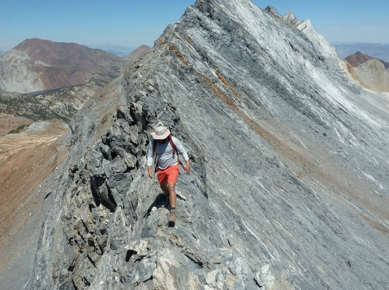
The ridgeline between Baldwin in Scheelore is class 2. The hardest part was the initial stretch, becoming a pleasant walk for most of the way. At the saddle, we passed by a rectanglar arrangement of rocks that we had trouble guessing their purpose – perhaps the foundation of an old cabin that once stood here? Mason and Gong came wandering back from the summit soon after that, taking their time and in no particular hurry. After reporting finding no register, I let them sign the one I’d brought for this purpose. I got to the top with Sean C and Grant where we left the register, then talked each other into continuing south along the ridgleline to the next summit, Peak 12,388ft. It would take a little over an hour to cover the mile of ridgeline, the best scrambling by far on the day. Grant of course was much faster, but he hung around long enough to help with some of the tricky route-finding before blasting away. This was the hardest climbing I’d done with Sean and he was showing himself to be a strong scrambler. There were knife-edges to negotiate – he even pulled out his camera while balanced atop one of these – and spooky downclimbing on loose rock. We kept an eye on our left for possible descent routes to avoid having to come back across the ridge on the return. Grant was waiting for us at the summit, seeming to be in no real hurry to get on with the rest of his day. When I asked where he was heading next, he pointed to the southwest towards McGee Pass Peak with a steep 500-foot drop inbetween. To my eye, the ascent across the gap looked awful but Grant sort of shrugged it off with a smile. To his eye, it probably seemed a minor obstacle. He planned to ultimately reach Red Slate Mtn before heading back. He soon got up and said his goodbyes, disappearing quickly down a chute just to our south.
Barbara and Gordon had left a register here in 1985, with half a dozen other entries since then – two of these were Scott Barnes and Sean O’Rourke on a previous Sierra Challenge. When we’d had our rest, Sean and I returned a short distance back along the crest before dropping off the east side to take advantage of a class 2 route we’d spied earlier. It was easier than the ridge traverse but tedious, getting us down to easier ground in about half an hour. Once down the talus slopes, Sean and I chose routes through slabs found below. My more direct route got me to the nice little meadow sooner, and after seeing that Sean was mostly down his route, I continued back on my own. I reconnected with the old road and followed this down, taking shortcuts with the help of the GPSr. Just as I reconnected with the road again after one of these, I heard Mason’s voice behind me on the trail, Zee and Gong in tow. We hiked together only a short distance before they slowed their pace and let me continue on my own. It would take another hour and a half to make my way back down McGee Canyon to return to the trailhead by 3p.
Since I was planning to sleep in my jeep again this evening, I had nowhere in particular to be and no reason to head off, so I stuck around for the next several hours until most of the participants had returned. Beer, snacks, and a bit of relaxing did wonders for a tired body. Later, a handful of us would drive up Rock Creek Rd to spend the night at the TH outside the packstation. There was surprisingly little traffic after sunset and I slept quite soundly there…
Fred finished more than three hours ahead of everyone else, ensuring his lock on the Yellow and Green Jerseys. Meanwhile, Grant was distancing himself in the Polka Dot jersey. He didn’t make it to Red Slate Mtn, instead choosing a longer, harder route to Red and White Mtn several miles to the south which would allow him to tag other bonus summits. He now had 15 peaks in only two days. Emma and Zee were tied for the White Jersey with identical cumulative times.
Larkins Peak — Peak 11,940ft
Sun, Aug 9, 2020
Day 3 of the Sierra Challenge
Unofficially named Larkins Peak is located in the Mono Recesses area north of Mono Creek and well off the Sierra Crest. The name derives from the two subsidiary creeks on either side of it – Laurel Creek on the west and Hopkins Creek to the east. The summit has more than 600ft of prominence which had garnered my attention and its subsequent inclusion on this year’s Challenge. The quickest way to reach it is from the east, going over Half Moon Pass from the Rock Creek drainage. It would be the hardest of the first five days of the Challenge, with 6,500ft of gain spread over 16mi. Our starting point was the pack station along Rock Creek Rd where a number of us had spent the night sleeping in our vehicles.
The trick with the Half Moon Pass route into the Mono Recesses is finding the start of the use trail. Despite having used it already on several occasions, I led our line of eager participants into the pack station and immediately got lost – “Uh, this doen’t look right…” was all I could muster before one of the pack station folks working on some equipment pointed us in the right direction. Once on the pack trail heading south on the outside edge of the property, I knew to look for a trail forking west. I was about to give up and suggest we must have passed it when someone saved me with, “Is this it?” It was, and we were off and running. Not exactly running, but fast-pacing it along the trail as it makes its way through forest in the direction of Half Moon Pass and the Sierra Crest. There is more than one thread to the trail and each can be lost easily if not paying close attention. As a result, the group fragmented quickly, scattering folks about the cirque on the east side of the pass. Once in the upper half of the bowl, the trees thin out and one gets a view of the crest, though the pass is not exactly obvious. I pointed out what I believed to be the correct notch to the few companions I had with me, actually getting it right, a little to my surprise. Not everyone would get it right, but enough did that Sean R and I found a handful of other folks at the pass when we arrived at the end of the first hour. Fred had already gone over the other side, but David, Emma and a few others were pausing to catch their breath here.
Sean and I almost immediately went over the other side and down the loose, sandy chute to avoid congestion and the dangers of rockfall if too many try to go down at once. Ahead of me, Sean ended up taking a more southwesterly line down to Golden Lake while I turned northwest to head more directly to the north side of the lake where I expected to pick up a use trail. This left me on my own, and in usual fashion I didn’t wait around for anyone to catch up. Below the lake’s outlet, I found the use trail and followed it down to the Mono Creek Trail. Once at the junction, the trail becomes a well-worn path which I continued descending. Larkins Peak can be seen rising high above the drainage shortly before reaching the trail junction with the Hopkins Lake Trail. Once at the junction, I was some 600ft lower than our starting elevation, marking the start of the 2,800-foot climb up to the peak. The spur trail was in good condition and easy enough to follow all the way to the lake, found about a mile northeast of the summit. Where the trail peters out near the edge of the lake, I went west around the lake’s southern end and continued cross-country, now mostly above treeline. My route led over the North Ridge of Pt. 12,056ft, then into the cirque on the north side of Larkins Peak. I had still not seen another soul since Sean back at Golden Lake hours earlier.
The only really tedious part of the route so far was the ascent ahead of me, climbing the steep, loose headwall at the south end of the cirque that would take me up to the saddle between Pt. 12,056ft and Larkins. As I started up this, I noticed a climber coming across the cirque behind me, Clement as I would soon find out. Almost casually, he caught up to me with seeming ease, we waved, spoke briefly, and handily beat me up to the saddle. The going from the saddle to the summit gave no respite, not as steep perhaps, but the broken rocks became larger, requiring more effort to surmount them. Seemingly out of nowhere, Fred came clambering down from above. It should have been no surprise, but I thought maybe today my route-finding would get me to the summit before him. No such luck. We talked about his idea of bypassing Hopkins Lake on the return by dropping down the southeast side of the saddle directly to Mono Creek. It seemed a good idea, but because I wanted to visit a bonus peak to the north, I wouldn’t follow suit. Later, Fred would report that the alternate route worked quite well.
It was almost 10:15a before I had joined Clement at the summit. Well, I wasn’t first or second, but at least I was third, right? We would leave a register here denoting that, but I would be wrong. Chris Kerth had beaten even Fred to the summit, I came to find later. I enjoyed the views which took in most of the Mono Recesses. I was intrigued that Lake Thomas Edison could just be seen below Mono Creek to the west. Ritter/Banner and a number of Yosemite peaks could be seen to the northwest, Red & White, Baldwin and the previous day’s peaks to the north. We hung around the summit for about 15min or so, but it seemed no one else was near so we headed off towards the nearest bonus, Peak 11,940ft. We started along the ridgeline connecting the two summits, but it was soon clear that this would be tedious with large granite blocks piled haphazardly along the initial portions of it. As we dropped off the crest we noticed a group of four heading up in our general direction. We paused to meet briefly with Mark, Sean, Chris and David, then continued traversing the east side of the ridgeline for another half hour to reach the saddle just south of the summit. With Clement well out in front, I was making my way up from the saddle when I spotted someone on the way down. It turned out to be Chris Kerth. I had guessed that he’d gone to the bonus peak first and was now on his way to Larkins, but quickly found that he’d already been there. This Chris was sneaky and fast. I asked if he’d found a register on top, and after replying that he had not, I let him sign one of the registers I was carrying with me before we parted ways.
Short digression. In my travels around the west side of the Sierra this summer, I came to notice that Chris Kerth had been to many of the obscure summits I was visiting. Based in Roseville near Sacramento, he’d spent quite a bit of time collecting all sorts of summits in the Northern Sierra and elsewhere in the state, over 1,000 in all, many of which I’ve yet to set foot on. On LoJ, he had somehow snuck up into 7th place on the list of CA summits without me taking notice, ahead of the likes of Richard Carey, Mark Adrian and a host of others. In looking at his recent ascents, I saw that he’d been to Balloon Dome and Pincushion Peak, among other obscure summits in the Ansel Adams Wilderness that I thought were impressive to do together on a backpack trip. So I contacted him through PB to invite him to the Sierra Challenge and was happy that he accepted, even if just for only one day. Turns out he’s pretty darn fast, too. I hope we’ll see more of him in the future.
I reached the summit of Peak 11,940ft by 11:15a, finding Clement relaxing in his usual fashion. He had surveyed the northwest side of the peak already, suggesting cliffs would recommend against a descent on that side. So after leaving our new register, we headed back down to the saddle, then dropped off the southeast side. At the base of the class 2 talus slope, we parted ways as I headed down towards Lower Hopkins Lake and Clement headed northeast towards Robber Baron Peak. He would be the last participant I would see for the rest of the day. I returned to the lake to pick up the trail, but was soon distracted when I came across a nice little swimming hole along Hopkins Creek. I stripped to take a short but refreshing dip before continuing on my way. I decided to skip the trail so I could enjoy some cross-country adventuring on my way down to the Mono Creek Trail. Once back at Mono Creek and the main trail, I settled in for the several hour hike back up to Half Moon Pass. I discovered the older, now abandoned version of the trail between the Pioneer Basin junction and the Mono Pass junction. This worked nicely to keep me from running across other users including at least one packtrain bringing provisions down from Mono Pass.
When I was back at Golden Lake I stopped for a second swim, finding the waters too idyllic-looking to pass up. I was back up to the pass by 2:30p and soon cruising more easily down the east side. It would take another 50min to find the trail and my way back to the pack station, finishing up by 3:20p. I was the second one to return, Fred having finished up several hours earlier and already on his way. I would run into him later at the Vons in Bishop where we both were staying the next few nights at the Motel 6. This would be my first night sleeping in a bed in almost a month, and I must say, I’d almost forgotten how luxurious that felt…
Fred continued to increase his lead in the Yellow and Green Jerseys. Grant maintained his lead in the Polka Dot with 20 peaks in three days, five ahead of Clement. Zee took a rest day, leaving Emma in the lead for the White Jersey.
Peak of the Four Winds — Peak 12,580ft
Mon, Aug 10, 2020
Day 4 of the Sierra Challenge
Day 4 of the Sierra Challenge saw us visiting Peak of the Four Winds on the Sierra Crest northwest of Four Gables. The name is given in Andy Smatko’s Mountaineer’s Guide to the High Sierra, a book that went out of print almost as soon as it was released in 1972. Our starting point was the Pine Creek TH. I’d been warned that a large portion of the parking lot had been roped off by the pack station folks, but when we convened there in the morning there was plenty of room for our vehicles and only a few spaces roped off. I was the last in line this morning at the 6a start, having trouble getting my GPSr working right from the start. Though only a few minutes behind the large group, it would take some time to catch up as we followed the old mining road up towards Pine Lake. I would eventually catch up to most of them singly and in pairs over the course of the hour and half it took to reach the first lake. Beyond this the going gets easier for a while as the trail passes by lakes and through forest on the way up towards Pine Creek Pass. I caught up with Chris at the Honeymoon Lake junction and together we made our way up the trail for another 30min until we were just below the pass. Chris stopped to get water while I continued up to the pass.
I waited a few minutes at the pass when I arrived around 8:40a, but Chris didn’t look to be coming up. I turned off the trail to follow the ridgeline east. This was a pleasant walk with an easy gradient and all class 1-2. Chris hadn’t bothered to hike to the pass, taking a shortcut that got him ahead of me. Once I’d caught up for the second time, we continued together, aiming first for the bonus Peak 12,580ft. This was pretty straightforward all the way to the easy summit, or so it seemed. We found Clement there ahead of us, thumbing through a register left by MacLeod/Lilley in 1985. It was a pretty busy register with more than 30 pages of entries. Well out in front, we wondered why he hadn’t already left for the Challenge peak to the south. He pointed to another point about 400ft to the northwest, asking “Is that point higher?” I looked carefully, lining up its summit with the one we stook upon and noting the further point’s line far to the northwest against Bear Creek Spire. It certainly seemed higher, and I recommended that to be fair we should probably visit it. With Zee joining us as a party of four, we set off along a very rugged section of ridgeline that none of us had any confidence would actually work. Clement did a fine job out front finding a class 4 route that would work, though not without some hesitation and some dicey sections. It took us about 20min to cover the short distance, but it was the best scrambling we’d found so far on the Challenge. I took an elevation reading from the GPSr and compared it to the one I’d taken on the first summit, and it came out about 10ft higher. Elated with our success, we left a register here before carefully reversing the route.
I went back to the lower summit to leave a note for other participants who would probably visit later, then continued on to Four Winds. It would take 40min to traverse between the two summits, most of it class 1-2. Somewhere in the middle was a class 2-3 section of ridge to get over and it was here that I ran across Genevieve on her way to Four Winds. About half a dozen had already reached the summit when the two of us arrived about 11:20a. The peak offers a spectacular view of French Lake, Humphreys Basin, French Canyon and a host of familiar peaks to the west. Mt. Tom rises dramatically to the east while Mt. Humphreys does likewise to the south. There was a register placed in 2008 by Mark Riner that had the peak as “Ramu Point,” with a handful of other entries before our arrival. While taking a break at the summit, I got to thinking that it might be shorter and faster to return via the Gables Lake Trail rather than return to Pine Creek Pass. It wasn’t obvious that one could get down the east side of the crest due to cliffs, but it seemed worth a try. The others were either not interested or planning to visit the bonus peak three of us had climbed earlier, leaving me to do this on my own.
We packed up as a group and started down, the rest of the group descending the North Slopes while I turned right to investigate a saddle to the northeast. As I expected, I couldn’t see the entire way off the east side but the saddle offered a good starting point. I might get down 300-400ft and find myself cliffed out, but I had plenty of time and energy to reclimb and return via Pine Creek Pass if necessary. The route worked quite nicely at class 2-3, taking about 30min before I reached easier ground. There was one tricky spot that had me hanging by some scraggily pine branches (probably avoidable), but overall it was quite reasonable. Once down to a small tarn in the upper part of the basin, the next 40min were spent making my way a little over a mile down an easy gradient, following the creek to Gable Lakes. I was careful to avoid anything that looked like a moraine, staying close to the creek for the most part. Interestingly, the creek disappears quite suddenly under some bushes in a shallow depression, going underground. Surprisingly, the topo map has this exactly right, showing the creek ending in a small lake with no outlet. The lake can only be present when the inflow is greater than the outflow capacity, so with little snow remaining, the lake has drained out. After climbing out of the depression and continuing east, I eventually returned to the creek and soon reached the higher of the Gable Lakes, making my way around the north side. After crossing the outlet, I climbed a short distance up the opposite side and found the trail I was looking for almost exactly where it was depicted on my GPSr.
It was now 1p and I had simply to follow the trail back down to the trailhead about an hour and a half away. The trail goes by some dilapidated cabins with mining gear and personal effects scattered about. Much of the tram that once carried ore more than 4,000ft down from the side of Mt. Tom still stands, its thick wooden beams and solid engineering looking set to last another 100yrs or so. The trail stays high on the west side of Gable Creek as it descends, swinging around to the west before switchbacking down to the Pine Creek trailhead. I arrived there at 2:25p, just five minutes before Asaka and baby Leif returned from their hike to Pine Lake. We set up camp here for the next few hours to wait for the others to return. An elderly woman came out from the pack station while I was sitting there and began to lament about 5-6 cars that were parked where they weren’t supposed to be – “How am I supposed to turn my trailers around?” Knowing that some of them were from our group, I got up to speak with her and try to settle her down. I told her that most of them were just day hikers who would be gone in a few hours, and apologized for the inconvenience. She continued, “I put ropes up and No Parking signs, why would they park there?” I admitted I didn’t know, but I looked around and noticed there were in fact, no such signs. “Where are the signs?” I asked. She paused for a moment before replying, “I took them down.” I sort of chuckled before asking, “Well, how would they know they weren’t supposed to park there?” Her face changed suddenly from a scowl to a sly grin before responding, “I guess I should lighten up.” We became fast friends after that, and I again reassured her most would be gone before evening. She got back in her truck and went about whatever business she’d originally planned back in town. The other participants came trickling in over the course of the next few hours. We had beers and snacks and stories to share all the while.
My descent route proved a good one, getting me back more than an hour before everyone else with the exception of Fred – he descended the same way and was back more than hour before me. His lead in the Yellow and Green Jerseys was now more than 11hrs. Grant added another six summits to his total, giving him 26 peaks in four days and increasing his lead in the Polka Dot Jersey. Emma maintained her hold on the White Jersey.
Peaklet
Tue, Aug 11, 2020
Day 5 of the Sierra Challenge
Day 5 of the Sierra Challenge was one of the easier ones planned, about 7mi roundtrip with 3,500ft of gain. It was designed to make for a half day’s effort, leaving us the afternoon for the annual cook-off at the Church of Grundy. COVID interferred with the cook-off plans, but we left Peaklet on the agenda. It turned out to be a decent summit with some dramatic scrambling.
The crux of the day was the drive to reach the TH, really only suitable for 4WD with high-clearance that could make it to the end of Buttermilk Rd. I drove up the TH the night before and was one of only two vehicles to make it – Sean Reedy’s Suburu Ascent being the other one. Most of the cars were congregated about 3mi down the road, necessitating extra hiking to make up the difference. Iris, Tom and Emma were the only ones to reach the TH by around 6:15a, so with Sean and I making a party of five, we set off on one of the spur roads that soon ends at the Wilderness boundary.
We had originally planned to hike around the peak to Longley Reservoir and then up the backside of the peak which is reported by Secor to be class 3. During our short hike along the trail, we reasoned that we could make a much more direct ascent up the peak’s East Face. The route looked to have plenty of vegetation that we expected would make for decent footing, and with that expectation we set off cross-country. In practice the route turned out to be tediously sandy and seemed to only get worse the higher we got on the mountain. With 2,600ft of gain from where we left the trail, it would take close to 2hrs to complete the climb. At least the views were pretty nice – Mt. Locke and Checkered Demon were colorfully displayed to the south. Mt. Humphrey’s and its East Ridge dominated the scene to the west. The tamer environs of the Buttermilks dropped off to the east below us.
I was the first of our five to reach the summit, discovering to no great surprise that Clement and Fred had handily beaten us to the top though we had not seen them the whole morning. They had arrived at the TH shortly after our departure and took the roundabout route to the backside, climbing one of two chutes found there to the summit. Or what they thought was the summit. When I joined them on the small perch of the uppermost rocks, I looked across to the north and spied another point of similar height about 50yds off, separated by a 60-foot notch. “Are you sure you’re on the summit?” I enquired. They were not sure. I asked if they found a register (No, they hadn’t) and pointed to a small stack of rocks on the other summit. Reluctantly they agreed that we had to check out the northern point.
Clement led off on the direct route between the two summits. Not liking the look of the climb up to the north summit, I chose to downclimb about 100ft in the chute the others had ascended, then climbed up to the sloping slabs on the north summit’s west side. This proved a bit dicey and I had no desire to downclimb it. Sean and the others had reached the south summit, watching the antics of the three of us. I called up to suggest they *not* use my route. Wisely, the rest followed Clement’s direct route which turned out to be not as hard as it had looked (to me, anyway). By either route, the peak turned out to be more exciting that we had expected and despite tedious ascent route, I was giving the two summits high marks. The GPSr showed the north summit to be about 9ft higher and Jason Lakey had left a crude register here in 2016, writing on a scrap of cardboard and leaving it in a gatorade bottle. He had also left a damaged indian spear point which we found most interesting. We left it in the new register canister we provided for this fine summit.
This was the longest time I’d yet gotten to spend with Fred, our Yellow Jersey leader, who’s usually come and gone from a summit before I’ve reached it. We had seven of us spread out on the not-so-large summit area where the conversation turned to descent routes. Clearly the fastest way would be to go back over the south summit and then bomb down the sand slopes on the east side, but I was curious about the two chutes on the backside of the mountain. It was just 9a, so I figured I had plenty of time to do some exploring and decided to head down the northern of the two chutes (Fred and Clement had ascended the southern one). The descent from the summit was some stiff class 3, but nothing as dicey as the route I’d used to ascend the north summit. The chute was mostly class 2 with a few constrictions that called for some more class 3 scrambling. The bottom of the chute dropped out over what seemed like a cliff, but it was easy enough to traverse southwest across easier ground before reaching the talus slopes at the bottom. From below, the northern chute is difficult to discern and only the southern one is obvious. As Clement and Fred reported, the southern chute is fairly easy and straightforward, leading to the notch between the two summits. The only real plus for the northern chute is a slightly easier scramble to the higher north summit once the chute has been ascended.
I made my way north across sandy benches and granite slabs to the east of Longley Reservoir. The water is a sickly green, the result of glacial silt and probably devoid of fish. I had entertained the idea of swimming in the lake, but the silt somehow discouraged me. Emma, meanwhile, had decided to take my descent route about ten minutes after I had headed down. I never did see her, but she stopped for a swim before returning to the TH about 20min after me. The others all decided on the east side descent. Mason and JD had gotten a later start, and were ascending the south chute on the backside while I was descending the other chute – I never did see them until after I’d returned. I eventually found the trail below the lower lake on the north side of the creek and followed the sandy path for much of the last hour back to the TH. Sean had arrived about 20min before me and was there at the TH. Fred and Clement had gotten back more than an hour before Sean and had probably already done the three miles back to their vehicles.
I waited around for most of the others to return including Emma, Iris, Tom and JD. We then drove down to the other vehicles and used my towstrap to pull Emma’s truck out of the deep sand she’d gotten stuck in. So much fun for one day and it wasn’t even noon yet…
Hermit South
The Socialite
Wed, Aug 12, 2020
Day 6 of the Sierra Challenge
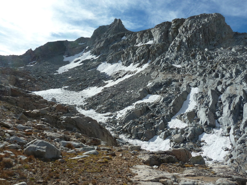
Day 6 would be the hardest of this year’s Sierra Challenge, a 21mi effort with more than 8,400ft of gain. Unnamed Peak 12,342ft lies deep in the heart of Kings Canyon NP, a short distance and slightly higher than its more well-known neighbor, The Hermit. In an email exchange with Eric Su six months earlier, he informed me that the summit was called “The Socialite” in the register which he had visited in 2018. I thought it was a nice complement to The Hermit and used that as the name during the Challenge. Only later would we realize that Eric had climbed an adjacent summit, leading to some naming confusion. After the fact, to avoid having two summits with the same name, I called the Challenge peak Hermit South and use that name in this report. Our route to reach it would start at North Lake, go over Lamarck Col into Darwin Canyon, descending to Evolution Lake before traversing south across the upper basin of Evolution Valley, and finally climbing to the summit. Most of the folks heading over Lamarck Col were heading to other destinations, notably The Hermit and Mt. Darwin. Our 5a start would allow for a full day and then some. Not everyone would get back before dark, with some not returning until nearly midnight.
Our route began at the North Lake parking lot by headlamp, heading up the road through the campground and then onto the Lamarck Lakes Trail. We were able to put our headlamps away after about 30min when in the vicinity of the Grass Lake Trail junction. Our group was spread out by this time and only a handful were still in sight when I reached Lower Lamarck Lake and crossed its outlet on a rickety set of logs. The trail continues up towards Upper Lamarck Lake with a helpful sign now installed where to turn off for Lamarck Col after crossing the creek a second time, but before reaching the upper lake. I caught up with Zee and his two pals at the top of a series of short switchbacks that lead to the next drainage southeast of Upper Lamarck Lake. We hikedthe sandy bowls in the parts of the mountain above treeline to r each the small lake below Lamarck Col. The snowfield was still present requiring some snow travel, but it had a decent boot track that could be followed without axe or crampons. Just before the pass, a trail-running couple passed by on their way to Mt. Sylla – an even more impressive destination. We spoke only briefly before they went up and over the col and out of sight. I found Sean Casserly at the col, having started early. He asked if anyone else was going to Mt. Darwin. I smiled and told him the three guys just behind were planning to do just that.
I waited less than a minute before going over the pass around 7:25a. It was too cold to wait very long in the early morning chill. I was by myself for the next 30min or so as I descended into Darwin Canyon, following one sandy use trail or another. While following around the north side of the lakes that dot the bottom of the canyon, I came across the trio of Tom G, Tom B and Iris, who had all started before 5a. I settled in with this group for the remaining descent of Darwin Canyon and Darwin Bench below that. By the time we had reachedthe JMT and the outlet of Evolution Lake around 9:15a, we had picked up Mason and Rafee as well. We crossed the large lake’s outlet, passing a couple camped at the edge looking west into Evolution Valley. On the south side of outlet we passed through an older guy’s camp with enough stuff for two or three friends (In fact, he had several friends that were currently off climbing Mt. Darwin.) A large, stainless steel box held a cache of food, obviously brought in by a pack train. I waved to the gentleman as I passed by, to which he asked the group if we were headed to The Hermit. Someone replied in the affirmative and asked if he’d been there himself, to which he responded, “Nine times.” I thought, “Huh, that’s a funny summit to make so many repeat ascents on,” but didn’t give it more attention until someone said, “Hey, that was Doug Mantle!” I made an immediate U-turn. I’ve missed seeing Doug in the wild on several occasions, sometimes by hours judging by the register entries at the summits. I had recently had a lengthy email exchange with him regarding ascent records of Andy Smatko but had never talked with him in person. I went back to introduce myself and take a photo of him in his natural habitat. A few photos were taken of the two of us together, and we were soon on our way. I think the whole exchange took place in under a minute.
In leading our group on the traverse past Doug’s camp, I stayed a bit too high and got us onto some class 3 slabs and steps that slowed everyone down. I had soon gotten ahead, turned around to show Mason a ledge I’d utilized, then lost everyone for good. I crossed the stream at the bottom of the cirque between Hermit South and The Socialite, then started directly up for the NE Ridge of Hermit South. I’d look back occasionally but didn’t see the others and had little reason to, since they were heading to The Hermit first. I stayed on the east side of the ridge to avoid larger blocks on the ridge proper, eventually gaining the ridgeline for the last few hundred yards. It was close to 11a when I topped out, finding Sean Reedy already there. He had started before 5a, too, and was carrying the rope the group planned to use for The Hermit. I thought it was funny that he went to the Challenge peak first, but he surmised (correctly) that he could reach it and get to the Hermit about the same time as the others. While we were chatting there, Grant came up from the east side, having just finished the traverse from The Socialite. A few minutes later, Clement showed up as well, having followed Grant from the previous summit. Sean got Grant to carry the rope since he was faster, and the three of them headed off to The Hermit. I sat around for another ten minutes, in time for Tom B to show up, having taken much the same route as myself. I’d forgotten that he’d already done The Hermit and would be following after me. We hung around for another ten minutes to give him time to take a break. I took some photographs of the surrounding monarchs – Mendel & Darwin to the northeast; Haeckel, Wallace, Spencer to the east; Goddard, McGee to the south, Emerald to the west. We left a new register under a small cairn at the end of our stay.
Together, Tom and I set off for The Socialite, an enjoyable class 2-3 scramble along the connecting ridgeline, much as Grant and Clement had described it. We stayed on the ridge for the descent to the saddle, then stayed on the south side of the ridge on the way up to the second peak to avoid difficulties. It took us an hour to cover the mile distance between the two, arriving around 12:30p. Trey Hawk caught up with us at the summit. He had come out to join the Challenge for a day unannounced, having gone to The Hermit first, soloed it, then continued on to Hermit South and The Socialite. I’d never heard of this youngster, but he was clearly skilled and as fast as Grant & Clement. The register on the summit had been left by MacLeod/Lilley in 1983 and was surprisingly busy with more than 40 pages of entries. A Dylan and Rob dubbed it “Socialite Peak” in 2006 which then became “The Socialite.” Eric’s entry in 2018 confirmed my suspicion that he’d not climbed the Challenge peak after all.
From The Socialite, Tom and I descended the northeast side while Trey followed the ridge to the southeast before turning north. We were headed to Pt. 11,576ft above Evolution Lake that Clement had told us had an interesting register. I lost Tom somewhere on the class 2-3 slopes leaving The Socialite, but met up again with Trey just below Pt. 11,576ft. The interesting register turned out to be an interesting steel box with a tattered and burned and mostly unreadable small piece of paper. Clement’s name was the only one we could discern on the brittle scrap. When I expressed my disappointment to Clement later, he just laughed – I think he was just trying to see if he could get us to do some extra work. Trey and I descended Pt. 11,576ft via different routes, rejoining for a second time at Evolution Lake’s outlet stream. We hiked back together on the JMT and the use trail leading up to Darwin Bench. I stopped to take a swim there while Trey headed off, no doubt at a much faster pace. It was the last I saw or heard of him, but I hope we’ll see more of him in the future.
The swim was a refreshing delight with a fine rock from which to dive into deep, clear water. It was nice to clean off the salt and sweat and give the legs a bit of a rest. After dressing, I downed my doubleshot of espresso to help me with the final climb back over Lamarck Col. It did a remarkable job of getting me up through Darwin Bench and Canyon, though it was wearing off by the time I started the steepest climb an hour later. I took my time getting back up to the col, reaching the day’s highpoint for the second time just before 4:30p. I thought I might start seeing other participants as I descended back down, but I saw no one since Trey and I had parted ways back in Darwin Bench. For a change of pace, I took the old trail down to Grass Lake, bypassing Lower Lamarck Lake and much of the morning’s route. The only person I saw on the trail since Trey was a photographer setting up for a photo of Piute Crags around 6p, not far from the campground. After passing by the TH at the campground and just before I had walked the half mile of road to the parking lot, Clement and Grant came jogging up behind me, all smiles. They had evidently had as much fun today as I had, perhaps more…
It seems that those that had gone to the Hermit first had also gone to Hermit South afterwards, and most of those to The Socialite as well. This meant that some were coming back after 11p, having been out for more than 18hrs. Fred had been to Hermit South and left before I arrived, having gotten back almost three hours ahead of me. His lead in the Yellow and Green Jerseys had gone from Insurmountable to Ridiculous, now more than 11hrs. Grant now had 30 peaks in six days for the Polka Dot Jersey lead. Zee had made it to Mt. Darwin, though his friends did not. He was now within one Challenge peak of Emma who had left for home the previous evening.
Echo Peak
Thu, Aug 13, 2020
Day 7 of the Sierra Challenge
Unofficially named Echo Peak rises above Echo Lake just north of the Sierra Crest and Mt. Powell. The name derives from Andy Smatko’s Mountaineer’s Guide to the High Sierra and is given as class 4 via the NW Ridge. It is imposing when viewed from most vantage points and there were no modern records to be found online. Tom Gundy had taken a picture of it from the northwest recently and suggested one possible line. Kristine Swigart and pals had climbed it two days earlier but gave away no secrets, simply describing it as “Fun!” Our starting point would be Lake Sabrina, complicated by construction efforts taking place at the dam that blocked some of the few parking spots available at the trailhead. Because of the late return many participants had the previous day, there were only a handful for our 6a start – Grant, Clement, Fred, Tom B and Zee (who planned to go to Mt. Wallace instead). I was feeling outgunned by the first three heading to Echo Peak as they were all much faster than myself and it took only a few minutes after we started off that I was hiking the trail on my own.
It had been a number of years since I’d last traveled up the trail as it climbs above Lake Sabrina to Blue Lake. It was nice to revisit this area after a seven years’ absence. I turned right at the trail junction past Blue Lake that would take me to Dingleberry Lake, following it as it descends one drainage and ascends another. I was a little surprised to see Fred just past the creek crossing beyond Dingleberry, two hours after starting out. He was taking it easy today, hiking with Clement and Grant doing likewise a short distance ahead. We followed the Hungry Packer Trail to Sailor Lake, leaving the trail to traverse into the next drainage to the southeast, past Moonlight Lake and then ascending the drainage towards Echo Lake. Grant ended up ahead of the rest of us, and the next time we saw him he was high on Echo’s NW Ridge, though how he got there was unclear. We reached the base of Echo Peak around 9:15a and paused to consider possible routes. We didn’t take to Tom’s suggested route further upslope – it looked kinda hard with snow potentially blocking it (though later it seemed that might have been the easier route). Fred and Clement decided to explore possibilites on the right (west) side of the ridge while I chose to ascend halfway up the drainage before tackling the ridge. Both routes worked, but not easily, in the class 3-4 range. I was found my route a bit dicey and hoped not to have to return the same way. I met up with Clement on the ridgeline about 40min later. Fred hadn’t liked Clement’s chute and went and searching around for an alternate. We wouldn’t see him again for a while. On the ridge we continued higher until stopped by more vertical terrain. We first explored around to the right (south), but found this cliffed out quickly. We might have been able to drop down a steep chute and up another, but I suggested we try around the left side where a ledge gave some hope. This worked nicely, taking me on a traverse across the north side of the ridge and around a lower west pinnacle where I could then start climbing back up. Clement appeared atop the lower west pinnacle via a much harder route. He could see that my route offered promise above where I couldn’t see. More class 3 scrambling got me to the chute on the north side between the west and east summits. From there, it was a fun bit of scrambling along the ridge to reach the highpoint. Clement was right behind me and soon joined me at the summit around 10:30a.
We looked around for Grant but saw no sign of him. We knew he planned to follow the ridge south to Mt. Powell, but this looked like a very difficult prospect. Clement had wanted to do similarly, but after surveying the terrain, decided against it. Later we learned that Grant had indeed gone that way, describing it as a little desperate but doable. I looked around for the register that Kristine had told me she’d left, finding it wedged under a rock near the summit. It was hidden quite well such that Grant never saw it. We signed it and left in the same location. With some discussion, we thought we could make our descent easier by dropping further down the chute we had ascended near the end. As we started down, we spied Fred making his way up. I had to chuckle because this was the first summit I’d beaten Fred to in seven days. He was nothing if not relentless. We continued down as he went up, figuring he’d soon catch up to us. Near the bottom of the chute where it begins to drop away, I found a rap sling on the eastern edge. The descent beyond that seemed a difficult enterprise, so I recommended not doing so. Fred would later report that he had descended this way and it worked well, and Tom G would also report ascending/descending the same. After descending further in the main chute, Clement and I began traversing the ledge system I’d used earlier and returned to the NW Ridge. From there we went all the way northwest to the edge of the shoulder and looked for a way off that side towards Echo Lake. Finding only cliffs, we backtracked and used Clement’s class 3-4 chute partly-filled with snow that made for an interesting descent. After we descended to the easier class 2 talus rubble, we split up, Clement heading west to Picture Peak while I started back down the drainage.
I spent the next 20min or so enjoying the easy descent through the grassy valley, eventually spying a figure in yellow making his way up. I veered over to intercept Tom G and spoke briefly with him. I was surprised (but shouldn’t have been) when Tom told me he’d just spoken with Fred. Seems he’d figured out a much quicker way down from Echo and had gotten ahead without me even suspecting. Tom and Iris had gotten a late start because of the long previous day. Tired and moving slowly, Iris decided to stop at Moonlight Lake and let Tom go ahead. The weather was looking pretty threatening over the Echo Peak by this time, but Tom shrugged it off. He would get lucky with nothing other than a few drops over the next few hours as he made his way up and back. I continued downstream, soon finding Fred taking a break to get some water. He was in fine spirits, describing his fortunate descent route and overall enjoying the day a good deal. He was in a social mood, choosing to hike with me the rest of the day rather than run off ahead. We ran into Iris and Tom Becht by Moonlight Lake. Tom had returned after getting as far as Echo Lake. He had watched the rest of us ascend the various routes on Echo Peak, hung out for a while and then returned back down the drainage, finding Iris at Moonlight Lake. They came over to meet us for and we talked for a few minutes before everyone continued down. Fred and I got well ahead and soon on our own again. It would take us another two hours and change to make our way back down the trail to Lake Sabrina and the TH, finishing up at 2:45p.
I hung around the TH for an hour or so, enjoying an early happy hour with Tom and Iris up their return. Afterwards, I headed back to Bishop where I got a few supplies, found some free wifi to get some pictures uploaded for the Challenge, then headed to Big Pine and the South Fork TH where a number of us would spend the night. Another big day tomorrow…
There were no changes or significant developments in the jersey standings. Grant had had another big day, tagging all three of the Powells, Mt. Thompson and Ski Mountaineers Peak to give him 36 peaks in seven days now.
Middle Palisade
Excitement Peak
Fri, Aug 14, 2020
Day 8 of the Sierra Challenge
Day 8 would be the second hardest of this year’s Sierra Challenge with 6,800ft of gain over the course of 13mi. Unofficially named Excitement Peak lies on the Sierra Crest in the Palisades region between Disappointment Peak and Middle Palisade. It has little prominence, first appearing in Secor’s guidebook as a pinnacle to be bypassed on the Middle Pal to Disappointment traverse. Matthew and I had done just this in 2005 when we did the traverse from Balcony Peak to Disappointment to Middle Pal. Secor gives no actual description of climbing the minor summit and I could find no information online, either. Clearly folks had been to the summit as the locally-derived names suggests it was found to be a spicy undertaking. I didn’t know if I would personally be able to reach the summit, but it seemed a worthwhile adventure and why it landed on the Challenge this year.
We had a modestly-sized group of about 7-8 for the 6a start from the South Fork trailhead. The trail up the South Fork Big Pine Creek is a familiar one, about five miles to Finger Lake if one uses the shortcut to bypass Brainerd Lake. There are two places that seem to change over the years, the first being where to cross the creek. Without a fixed bridge, the crossing can be treacherous in high water, more tame late in the season. Today was closer to the latter and I was able to get across on rickety branches without taking my boots off or, as sometimes happens, falling in. The second change is where exactly to find the Finger Lake shortcut. I was on my own for this section, thankfully, because despite having used it at least half a dozen times, I pretty much botched it this time and ended up on terrain both brushier and rougher than it needed to be. I reached the outlet of Finger Lake by 8:15a, finding Mason just on the other side. Others were not far ahead starting up the boulder fields above the lake. Mason and I followed a route closer to the lake that offered no real advantage over the more direct line further to the west and we got a bit behind the others. Mason was moving slowly today, having not yet recovered from his 19hr+ outing the previous day, and decided to take a rest while I pressed on. He wasn’t feeling it today and would turn back without making it past the glacier – similar to where I turned back on my first effort during the first Sierra Challenge in 2001. I continued up on my own, reaching the edge of the moraine shortly after 9a.
The moraine is the loose pile of rock left by the receding Middle Palisade Glacier. Ahead I could see a couple of figures, Zee and Fred making there way higher still up this loose collection of unpleasantness. I followed their route across a couple of low-angle snowfields to reach the medial moraine between the two halves of the glacier in about half an hour. I would have been better off following the others to the redish rock on the right, marking the standard route up the main chute. Instead, I was curious about the state of Secor’s route, a narrower chute just to the left. I’d brought crampons and ice-axe for just this purpose with the added bonus that I’d have the lower half of this route to myself with less concern for rockfall from others above me. I wandered out onto the glacier at its upper edge and found nothing that looked like the class 2 ramp I recalled when Matthew and I had used it 15yrs earlier. Thinking it was further left than I could remember, I continued along the upper edge of the glacier until I was almost directly under Middle Pal’s summit and found nothing but difficult terrain wherever I looked. I backtracked nearly to where I’d began on the snow before recognizing the ramp above me. Trouble was, the glacier has receded over the past decade and a half, exposing some terribly loose and steep terrain below the start of the ramp. I scrambled up this every so gingerly, but it very unnerving for that first 15-20ft or so, more like class 3-4 than class 2. I quickly found ducks above and the right-leaning ramp that would take me more easily up to Secor’s chute, helping confirm I was on the right route (later I would find I had a similar photo of the ramp from 15yrs earlier that showed it was the same ramp as well as some changes where rocks have shifted and fallen out of position). It doesn’t look like this route sees much traffic anymore, and with the increased danger I could see why. At the end of the ramp I followed more ducks around the corner and into the steep class 3 chute going straight up. The rock quality here is pretty descent and makes for some fun scrambling. The chute merges with the main chute after about 10min where I met up with Zee once more. He was moving more slowly now and I pulled ahead of him as I continued up the main chute for another half hour to reach the summit by 11:20a.
I found Sean K and Sean R already at the summit, Sean R getting ready to start for Excitement. Grant and Clement had already headed off and were out of sight. Sean K had reached his goal for the day and planned to rest up more before starting back down. The 1936 aluminum Sierra Club register was still at Middle Pal’s summit along with a number of booklets covering decades of ascents. I quickly signed into it so as to continue on to Excitement, hoping to take advantage of the others’ route-finding. The distance to Excitement was only about 600ft, but it would take me 45min to traverse between the two. The route starts off as a standard class 3 scramble along the ridgeline, losing little elevation until Excitement comes into view and the ridge drops off steeply. Grant was already at Excitement’s summit and Clement was close behind, following its steep and exposed class 3 NW Ridge, directly on the crest. The route looked reasonable to my eye despite the exposure, until a large block is encountered about 30-40ft below the summit. I watched Clement make an exposed move along a thin ledge at the base of this to reach a body-sized crack, then back off and call up to Grant for some direction. Grant told him he used the crack and then Clement carefully made the same moves, wedging himself in the crack before pulling up onto rocks above. It seemed an awfully dicey proposition to me. Not liking the looks of it, Fred had gone around to the left to look for another way up. Closer to me, Sean R had just finished reaching the chute on the north side of the notch between the two summits, and I didn’t have a chance to see how he got there. I called over to him for some help to which he indicated he’d gone down the northeast side before traversing across. With a few missteps, I finally managed to follow a similar class 3-4 path, meeting up below the notch with Fred already on his way back. He was a bit excited, eager to get off such treacherous terrain and probably wouldn’t be able to relax until he was back at Middle Pal. I was feeling similarly, but internalizing it more and cautiously making my way across. Fred had said that his route was probably easier and encouraged me to use it. After we parted, I moved around to the Northeast Face and was happier with what I saw there – steep, but looking less exposed and with more than one option. As I was moving up this face, Grant and Clement came down to my left, eager to get on with the traverse to Disappointment. They were calmly having a discussion about possible route lines as they disappeared below me. I found the left side of face had easier scrambling, no more than class 3 with good holds and decent rock. When I popped out on the summit just before 12:15p, Sean R was already there, having utilized Grant’s ascent route. Finding no register, we left one of our own to which we added the names of our companions who’d already left. The summit was a wild little perch that could hold a few folks comfortably with a wide-ranging view to the north and south. We exchanged waves with Sean K at Middle Pal’s summit to the west.
Almost as eager as Fred to get off this difficult terrain, we spent only a few minutes before carefully retracing my route off the NE Face. My route on the traverse back towards Middle Pal must have been a variation of the outbound route, because I came across a rap station that I hadn’t seen earlier. The return went quicker, only about 30min to reach Middle Pal’s summit. Zee had reached the summit and was just starting down not far below us. Sean K had left the summit earlier and was somewhere ahead of Zee. I was very careful to avoid knocking anything down with others below me, and for the most part kept to the east side of the chute to minimize having them in the direct line of fire. Near the bottom of the main chute, I came across David Park on his way up. He was probably about 45min from the summit at the pace he was moving, but seemed in good spirits and didn’t seem to mind that he’d be the last one off the summit today. I used the red rock route for the descent, loose and crappy for the lower part, but not really dangerous. I nearly caught up with Fred as I reached the top of the medial moraine, but he decided on a more direct descent down the glacier while I took the more roundabout way along the top of the moraine. I would catch up with him again past the glacier when he pause to empty snow and debris from his shoes. Further down the route, the two of us came upon Sean K above Finger Lake. I struck up a short conversation with the 16yr-old, knowing he had been eager and nervous to climb the peak which would be his hardest ascent to date. I asked him if he thought it was easier or harder than he expected. He replied enthusiastically, “Oh! Twenty million times easier!” He would be one to watch out for in future Challenges. We descended to Finger Lake where Sean K paused while Fred and I continued down. It would take us most of the next two hours to make our way back down (yet another version of) the shortcut to the Brainerd Lake Trail and then back down the South Fork drainage to the TH.
We were the first to arrive at the parking lot with Sean R only a few minutes behind us. I headed off to Independence where I had reserved a room at Ray’s Den for the next few nights. I was relieved to be done with the hardest of this year’s peaks, knowing the next two days should be considerably easier.
The only change in jersey status today was Zee reaching his 5th Challenge Peak to tie him with Emma for the lead in the White Jersey (under 25yrs). She had left after the fifth day, expecting to be done, but had decided to come back for the last two days, keeping Zee on his toes.
Nameless Pyramid
Sat, Aug 15, 2020
Day 9 of the Sierra Challenge
The oxymoron that is Nameless Pyramid lies atop the Sierra Crest a short distance south of Kearsarge Pass. I’ve gone by it on more than a dozen occasions while heading to any of a number of other summits in the area, often pausing to think, “I should climb that thing.” What had kept me from doing it previously was the stiff rating of its exposed summit block – class 5.7x, where the “X” refers to the unprotectable nature of the ascent up the narrow, 45-degree granite fin. Tom Grundy had soloed it three years earlier during the Challenge and described it in nervous terms that contributed greatly to my apprehension. But it did have a bolt up top that he thought might help to set up a top rope and allow some degree of protection, even if mostly psychological. Because it is only about 30ft high and the approach is quite short, we didn’t expect to have much difficultly getting it done in a reasonable time even if we had a large group. Tom graciously accepted the role of climbing manager for the day, choosing the gear, setting up the top rope, and managing a dozen folks up the short pitch. Additionally, JD was finishing the SPS list today. Originally, it was planned to be on Tinemaha, but that area was closed until the end of the year due to a fire. So it was moved to University Peak, a summit we’d already done on a previous Challenge, but was conveniently (or not so conveniently, as we came to find out) near Nameless Pyramid. The idea was to finish up with the Challenge peak as soon as possible, then head to University.
The obvious route is to take the Kearsarge Pass Trail from Onion Valley, then follow the ridge south to the base of Nameless Pyramid. Secor rates the ridge as class 3, and most of the participants followed this route. From the satellite view, I had spied a chute southwest of Big Pothole Lake that might shortcut the Kearsarge Pass route. I had described this option in the online description for the day’s peak, but it seems I was the only interested, or curious enough to try it. Even with some tedious boulder-hopping to get around the lake, the route worked quite nicely, enabling me to beat everyone to the point on the ridge at the top of this east-facing chute. It was not a huge lead, however, as Fred and Clement both caught up to me rather quickly and were soon ahead for the last 20min it would take to reach the base of the summit block. Robert and Grant were the first to reach the peak well before everyone else, having ascended from the east via Heart Lake. Robert soloed up and down without a rope before anyone else had gotten there (described later as “not the smartest thing I’ve done”) and went off to Snow Crown, another summit to the south on the crest. Confused, Grant went after Robert towards Snow Crown, thinking it was Nameless Pyramid. They were both gone before anyone else arrived. It was 8:30a before I had reached the peak and would take another 30min or so for the rest of the large crew to gather there.
Trailing a rope, Tom G climbed up the north side of the granite fin, then set up a top rope utilizing the old bolt on top with some additional backup. Chris then lowered him off the east side of the summit block, and we were soon ready for the production line. With various folks sharing belay duty, one by one the group made the ascent up the north side. There would be little protection were one to fall off either side of the fin, so the best Tom G could instruct was to straddle the fin should one fall or slip. Most of the climb is straightforward, but there’s about a 3-foot section 2/3 of the way up where it’s steepest and a little slippery, and it was here that the real action takes place. There was much hesitating and cursing here by almost everyone. JD went first so that he could get on with the business of his list finish by heading to University by way of Snow Crown. He was followed by Chris and Fred. Fred struggled at the crux, choosing to climb on his knees rather than trust his shoes and had some blood-letting to show for it. He was the only one to leave a bit of himself on the rock today. Sean R, Mason, Emma, Iris and Sean C went up in turn. After descending, I had each of them sign a register I would place on the summit when I went up. Because there were no stones on top with which to shelter the register, we asked each person to carry a rock up with them. Most of these turned out to be the size of golf balls, not terribly helpful, but there were enough to cobble something together. I was second-to-last, finding it about as spicy as the others had indicated, though it took less than a minute of actual work to reach the summit. I left the register under the pile of newly acquired rocks, took a photo looking off the rappel side, then went down. Tom B went last, only because he hadn’t brought rock shoes and needed to borrow mine. Tom G went back up a second time at the end to collect the gear he’d used to back up the bolt before rapping back down. It was almost noon by the time we had packed all the gear away. A handful of folks had already gone after JD to University, but those of us still at Nameless Pyramid decided it looked like too much work – we would go back to Onion Valley to wait for JD and the gang and celebrate his list finish there.
There is an interesting series of ledges and ramps on the northwest side of the crest that I had used to reach the summit block, possibly the easiest way to reach it from the crest to the north. I led six of us down this 60-foot section that someone likened to a video game. We then continued north along the west side of the crest to the top of the chute I had used and descended that. After this, our group split up as we went about finding various ways around Big Pothole Lake and back to the trail. Tom B stayed high above the lake on the south side and reported easy sailing. Sean R and I stopped on either end of the lake for a swim before catching up with the others in the boulders and on the trail. Tom would get back 10min before the next group that included Sean, Mason and myself. Tom G and Iris would be an hour later still, stopping to take a couple of swims at the lower lakes.
Back by 2p, we settled in for a relaxing afternoon under Tom’s pull-out shade on the side of his Jeep. Adult beverages and salty snacks were consumed over the course of the afternoon. Clouds had built up threatening rain, but only a few sprinkles ever materialized. JD and the others from University didn’t return until 6p, by which time the rest of us were relaxed and feeling little pain. JD became only the third person to day hike the SPS list, ten years after the Matthew and I had done it in 2009 and 2010, respectively. Well done, JD!
For the first time in eight days, Fred was not first to return. Sean C got the stage win, though partially by accident. We had let him be one of the first to go up and back down so that he could return to Kearsarge Pass where his wife was waiting with their infant son. The plan was for Asaka to then scramble from the pass to Nameless Pyramid and take her turn. She didn’t like the look of the ridge as a soloing exercise and declined. Fred ended up half an hour behind Sean C and an hour ahead of the next person. Meanwhile, Clement went off to Snow Crown, Rixford, Falcor and Mt. Gould in a wide tour around Kearsarge Pass. Not to be outdone, Grant did all those plus Glacier Spike and six of the Kearsarge Pinnacles. Once he realized he had missed Nameless Pyramid, Grant planned to revisit it at the end of the day to solo it as Tom G and Robert had done previously. Unfortunately, later afternoon rain had left the rocks wet and he deemed that an unsafe risk. It was the only Challenge peak he would miss from this year’s list. Emma and Zee remained tied for the White Jersey with six Challenge peaks each.
Mt. Fitch
Sun, Aug 16, 2020
Day 10 of the Sierra Challenge
The last day of the Challenge had us revisiting Armstrong Canyon, a TH we have used sparingly in the past for reasons that have to do with its generally crappy and sometimes dangerous nature. Unofficially named Mt. Fitch lies on the Sierra Crest between Mt. Perkins and Striped Mtn. I had made a wide loop around it during the 2008 Challenge, an ambitious outing taking in Pinchot, Wynne, Perkins and Colosseum. Today was expected to be a far easier outing, made even easier with the Jeep. A rough 4WD road winds its way up from Scotty Spring (where any vehicle can reach) at 5,700ft to some old prospects at the base of Armstrong Canyon at 8,200ft, saving considerable time and energy if one has an appropriate vehicle. Tom B had driven himself, Iris and Tom G up the road around 5a to get an early start. I started up the road shortly before 6a, while Sean R drove himself and five others up, not far behind me. I failed to notice that Tom had parked around 8,000ft where the road forks, and continued to drive myself up to the top of the right fork, with a tricky bit of manuevering at one point to get around a large rock that had fallen onto the roadway (and used to block it, until someone did some road work to make it passable once again). Sean parked at the 8,000-foot level with Tom’s Jeep, his group starting from there. Sean talked the lot of them into an alternate route, going up the left road fork and climbing Peak 11,738ft and Mt. Perkins before visiting Mt. Fitch. This would take several hours longer, but a more interesting route. Consequently, I would not see any of them the rest of the day.
I started up Armstrong Canyon from my Jeep at 6:30a, first following a spur road to its end at 8,600ft where one of the prospects is found. I then traversed up and right through thinning forest to the northwest side of the canyon, aiming for the bottom of a wide chute on that side that would lead up towards Mt. Fitch. The canyon and chute were both disagreeable, characterized by sand and loose talus that made for tedious climbing. By far, this was the least enjoyable day of the Challenge for me, even though it was one of the easiest. The chute climbs 2,000ft in a very wide channel to reach the top of a subsidiary ridge at 11,300ft. It was nearly 8:30a by the time I topped out with Mt. Fitch now in view. More loose terrain along the spur ridge leads higher to a plateau on the east side of Mt. Fitch. The plateau offers the only respite from the steep gradients, but filled with morainal material, it has no pleasant features other than being somewhat flat. Rock and more rock, of all sizes, dominate the scene. Very little grows here, and what few green things manage to do so, look like they’ve been regretting it from the start.
As I was crossing the plateau I heard voices ahead and eventually spotted a trio as small dots moving slowly up the East Face, around the halfway point. I would not be able to catch them before they reached the summit. I topped out at the three hour mark around 9:30a, finding Tom, Tom and Iris relaxing in the morning sun and taking in the views. At least the weather was cooperating nicely, with fine conditions for a summit stay. In one our conversations weeks earlier, Tom B had jokingly agreed to vote for me as a write-in candidate for President in the November election. He had made a sign to this effect and brought it with him to the summit of Mt. Fitch as a surprise for me. The slogan he chose was appropriate – “Bob Burd for President – He’ll get the country back on top.” We took some photos with the sign, enjoyed the last of the Fireball Whiskey I’d intended for Colorado, and filled out a register to leave at the summit. There was some talk about bonus peaks including Wynne and Pinchot to the west, but in the end we all decided to head back. It had been a long week and it was probably time to be done.
The return followed my ascent route. The others had used an adjacent chute that they’d found better than the one I’d used, but we all went down the same mega-chute. Later they would wonder, with some disbelief, why I would subject myself to such a punishing route choice. My only defence was that I didn’t know better. I got well ahead of my companions, reaching the bottom of the chute while they were still halfway up. I got back to the Jeep by 11:40a, showered, and changed into fresh clothes. There was still no sign of the others, so I headed off to get started on the 8hr+ drive back to the Bay Area. I had been away from home for more than a month now and was starting to get just a twinge of homesickness. It had been a good trip, traveling across six western states with fine adventures, particularly the last ten days in the Sierra. Little did I know at the time, but the fires that would ravage the state for more than two months had just started around the Bay Area two days earlier from an unusual summer lightning storm. I would go home to brown skies and an orange-red sun that become the norm for weeks at a time. Trips would become increasingly difficult as closures were enacted to stave off continuing stupidness on public lands that was causing more fires, eventually consuming more than four million acres in California. Thankfully, the hills and mountains are quite resilient and will recover with time…
In his first Sierra Challenge, Fred Zalokar took the Yellow and Green Jerseys with 10 Challenge Peaks and a nearly 13hr lead over his nearest rival, a record. Grant Miller took the Polka Dot Jersey with a total of 51 summits over the ten days, the second-highest total in Challenge history. Emma Lautanen took the White Jersey with seven Challenge Peaks, the first woman to win a Challenge jersey. Congrats to all of them!
Fred Zalokar: Ascent national record: mount Aural fastest ascent record is now set
International adventurer David Minetti and the renowned mountain runner Fred Zalokar have set the mount Aural fastest ascent record on Monday the 17th of February 2020.
3 hours, 27 minutes and 06 seconds.
The fastest known ascent of Cambodia’s highest peak (1813m) has been recorded in the early hours of Monday morning: 3 hours and 27 minutes. Fred Zalokar 59 years old and David Minetti 42 years old ascended via the main Aural trail in a single climb. They left the village around 1.45AM to reach the established base camp (elevation 225m) around 3AM on Monday, February 17, and summited around 6.30AM on the same day. The evolution of the ascent was monitored by Jean-Benoît Lasselin and his team with a first check point at 1200m and a second at the summit to record the exact time of arrival.
Fred and David said they felt good all the way. Due to the sudden elevation the terrain, the team decided to start walking from the village of Aural for 8 km in order to warm up properly and start the ascent in the best conditions after a quick stop at the established base camp. “From this point, we did not stop. We went all the way to the top, and back” comments David Minetti.
Several speed records have been claimed on Aural but C4 Adventures, the organiser of this ascent, established the first fastest recorded time. “Overall, from the Aural village, David and Fred did a round trip of 7 hours 46 minutes 14 seconds and had an elevation gain of 2024 meters in total” concludes Jean-Benoît Lasselin.
The Aural mountain attracts every year more adventurers and trekkers as it is one of the toughest trail the climber will face with an average 50% inclination rate, including some 80% sections, a slippery terrain as the humidity level reaches 80% and an oppressive heat, from 36 degrees Celsius at the mountain feet temperature to 26 degrees Celsius at the summit).
#Auralmountain #FredZalokar #Ascentrecord
Smashing Fifty Interview!
Fred Zalokar: Beliefs and rituals of a marathon champion
Fred Zalokar and I recently connected on Twitter when he commented on one of my posts that he was about to “Smash sixty”. Intrigued I did a bit of research and discovered a man leading an extraordinary life from his base up in the Sierra Nevada mountain range, Nevada, USA.
Here is a man who has literally smashed his entire fifties to smithereens through his epic marathons, mountain expeditions and world travels.
I instantly knew that I wanted to find out more about him and share it with the Smashing Fifty family. So I requested an interview, to which he happily agreed.
During our Skype, Fred reveals just how he’s created one of the most exciting and fulfilling lives you can imagine, all whilst working a regular day job. Hold onto your hats, folks!
“I love growing old. It’s a lot better than the alternative.”
Fred Zalokar
An overview of the man
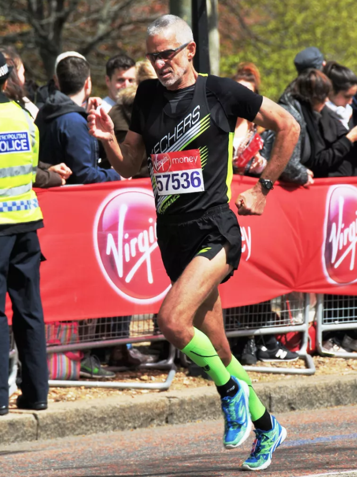
Winning the London Marathon for his age group, 2016.
Fred Zalokar is the first marathon runner to have won his age group in all six Abbott World Marathon Majors.
He won in Berlin 2010, Boston 2011, Chicago 2012, New York 2015, London 2016 and Tokyo 2017.
Originally an ultra-runner, it wasn’t until he turned 50 that he decided to try road running after being persuaded by his wife. Impressed? Me too, but that’s not all.
Fred has also traveled to 136 countries (scaling to the highest point of 78 of them) and has climbed 145 of the world’s highest mountains.
For the last decade, he’s been running 13 times almost every week, clocking up an average of 105 miles every 7 days.
Not bad for a family man who also works a regular 9-5 job, sometimes pushing 50 hours per week.
What’s even more astonishing, is that he doesn’t really consider himself to be that much of a marathon runner. Ask him and he’ll tell you that he prefers to think of himself as a “passionate traveler who also happens to climb mountains and run marathons.” His thirst for life is immense.
An inspiration to all middle-aged men
Almost sixty you say??? Ripped!
Here’s a man who has been unafraid to live his life on his own terms and has seen just reward.
His work ethic, focus, positive mindset and passion for life prove that anything is possible in life if you put your mind to it.
But let’s not be overwhelmed by the extent of his achievements (this guy’s taking it to the limit).
Instead, let’s be inspired by his determination, passion and focus and use it to inspire the rest of us mere mortals to smash our own challenges no, matter how big or small.
The interview
“I wake up at 3.30 am almost everyday and workout for two and a half hours.”
Fred Zalokar
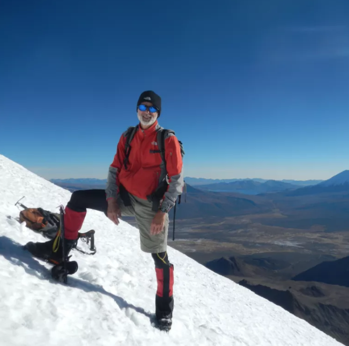
Fred sits comfortably in front of a bookcase crammed full of Lonely Planet guidebooks. He’s relaxed, friendly and unbelievably positive. His easy-going, super focussed attitude is infectious. I’m feeling inspired already.
To begin with, I wonder if he’s somehow superhuman or has the luxury of extreme wealth which allows him the energy and time required to become a world champion marathon runner, climber and travel so much. He tells me with a shrug that he’s neither. Puzzled I invite him to go on.
“It’s really quite simple,” he tells me… It soon becomes clear how he’s created his most amazing life.
Daily routine
I begin our conversation by asking him about his daily routine and indeed if he has one.
“Well, I wake up at 3.30 am almost everyday and workout for two and a half hours. I’m lucky because I work at a fitness club so I have access to the gym 24/7.
“I’ll be there on my own (which I love) and so I’ll get a good running session in on the treadmill.
“Then I’ll come home, shower and I’ll be at my desk by 6.30 am.
“I take one and a half hours for lunch during which I’ll have another running session. But Fridays are my day off, so I only do one session.”
I’m exhausted already… he continues.
“I’ll usually be in bed by 7.30 or 8.00 pm. When I’m at home that’s the routine. That’s how it gets done.”
I tell him how I’ve been reading about Tabata and other shorter exercise plans that suggest you don’t need to do such long workouts.
“It depends on your goals,” he tells me with a smile. “If you have the same goal as me…” he pauses and with a chuckle continues “… put it this way. You work out your way and I’ll work out mine. But the only time I’m going to see you is at the starting line.”
I see his point.
I ask if he ever feels like switching off the alarm and rolling over?
“NEVER. I never miss. You have to have that focus.
“If I do get sick and miss a day, I feel like I’ll have to make it up the next day and run three times.”
Is there anything you dislike about your training?
“No. If I didn’t like it I wouldn’t do it, and I’m so used to it now, that it’s like breathing. In fact, it’s harder now that I’m cutting back and just running once a day.”
(His new goal for 2019 is to smash the American record at the mile or 5k for a sixty-year-old, so he’s changed his routine to accommodate, running just once a day and increasing his strength training and diet accordingly).
He goes on to describe the workout that he did that morning (on a Saturday at 3.30 am!):
Strength workout
- 5 upper back exercises (3 sets of 25 per exercise)
- 3 chest exercises (3 sets of 25 per exercise)
- 2 shoulder exercises (3 sets of 25 per exercise)
- Bicep / Tricep (3 sets of 25 per exercise)
- Obliques (4 sets of 25 per exercise)
- Stomach (4 sets of 25 per exercise)
(The weights are increased for each set).
Personally, If I’m up at 7 am on a Saturday and do fifty push-ups I consider that a win. I’m beginning to see what real commitment, desire, focus and hard work looks like. Click to read the full article @ http://smashingfifty.com
Trip Report 10 – Friends in High Places
In June of 1994, my oldest friend, Todd Huston, began a project he called “Summit America”. Todd had a goal of breaking the record time for summiting the high points of all 50 states. The existing record was 101 days and was held by Adrian Crane, an ultra-endurance athlete. Adrian Crane has two legs; Todd has only one.
When Todd was fourteen years old, a boat ran over him, sucking both of his legs into the propellers. His left thigh was torn to the bone, the back side of his right leg was missing, and his right knee was sliced in half. The doctors were able to save both legs, but his right leg was paralyzed below the knee. The infection that plagued his leg for years led to the decision to amputate when he was 21. Todd is one of the toughest guys I know. His leg was amputated while he was wide awake. He asked to be anesthetized below the waist, and while he was talking to the doctor, they fired up the saw and amputated his right leg, below the knee. Anybody that tough can do anything they put their mind to.
I never treated Todd any differently than anyone else or showed him pity over what had happened to him. When he came to visit me in San Francisco 35 years ago, he hiked the hills all day on crutches. When my car wouldn’t start, I had him push it with one leg while I sat in the car and popped the clutch to get it going again. In hindsight, it was great training for his future.
Todd and I have always had each other’s backs, so when he ran into an unexpected challenge with his Summit America project, he knew who to call. Todd had initially invited me to be part of the expedition but I wasn’t able to take that much time off from work, so I’d had to say no. I offered suggestions regarding the sequencing of the climbs, including starting the time-clock at the summit of Denali in Alaska, the highest of the 50 high points at 20,320 feet. This suggestion changed the course of the climb and of Todd’s life.
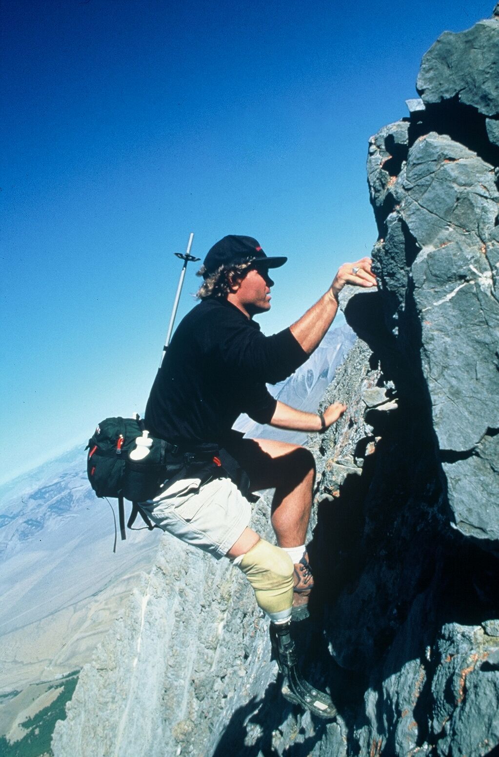
By late July, Todd had successfully summited 46 of the 50 high points and was well on track to break the record. I had been following his progress and was really excited for him. On July 30th, the phone rang. There was a problem in Oregon. A week earlier, a team of 5 climbers on Mt Hood had fallen. Two had died and two had been seriously injured. Apparently, there was a problem with snow melting due to unusually warm weather, resulting in serious rockslides on the mountain. Todd had already arranged for a guide to take him up Mt Hood, but due to the conditions and the fatal accident the previous week, his guide pulled out at the last minute. Todd tried to find another guide, but no one was interested in taking an amputee up the mountain in conditions that everyone considered dangerous.
I had climbed Mt Hood 3 years earlier, and I knew that it was not a technical, challenging mountain. In fact, Mt Hood is the second most climbed mountain in the world, behind Japan’s Mt Fuji. Climbers of all levels have successfully summited Mt Hood. I knew I could help Todd get to the top. I told him that if he’d pay for my ticket, I’d take the first flight to Portland and we’d get it done. I took the next day off, and Todd picked me up at the airport at 9:30 AM.
We headed to the hotel, where we met up with Whit, Todd’s climbing partner on this expedition, and Lisa, who was in charge of community outreach and logistical support. I assured them that Todd would be safe, and that we would have a successful climb and get the expedition back on track. On the way to the lodge, we visited a family whose little girl had recently had her leg amputated. Todd has always cared first and foremost about inspiring others; the climbing came second.
After dinner at the Timberline Lodge, as the sun was starting to set, Todd, Whit and I started our climb. We left about 8:00 PM, and climbed to Hogback Ridge, at 10,600 feet, where we made camp. Our camp consisted of three ledges that we made with our ice axes, just wide enough for a pad and sleeping bag. We anchored our sleeping bags with our ice axes, and then we slept from midnight to 4:00 AM. At 4:00 AM, when the snow was at its coldest and safest, we roped up and began our summit push.
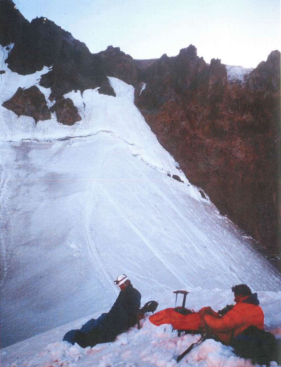
The conditions were good. We came to an open crevasse with a narrow snow bridge. I crossed to the other side and anchored the rope to belay Todd and Whit. With one major obstacle behind us we now faced the crux of the climb – a steep narrow gully of ice and loose rock. I led the pitch. Todd and Whit were staggered behind. As debris fell from above, I repeatedly yelled ”ROCK!” to warn the climbers below me.
We traversed carefully across the mixture of snow, ice, rocks, and mud as we approached the summit and were welcomed by a beautiful sunrise. We had done it. With smiles, high fives, and cheers, we took our summit photos, signed the registry, and started our descent. It was a race against the sun to get Todd and Whit down the mountain before the snow got too soft and warm, my main concern was the softening of the snow bridge. Todd glissaded down much of the mountain to speed up his descent and save energy from using his prosthetic leg.
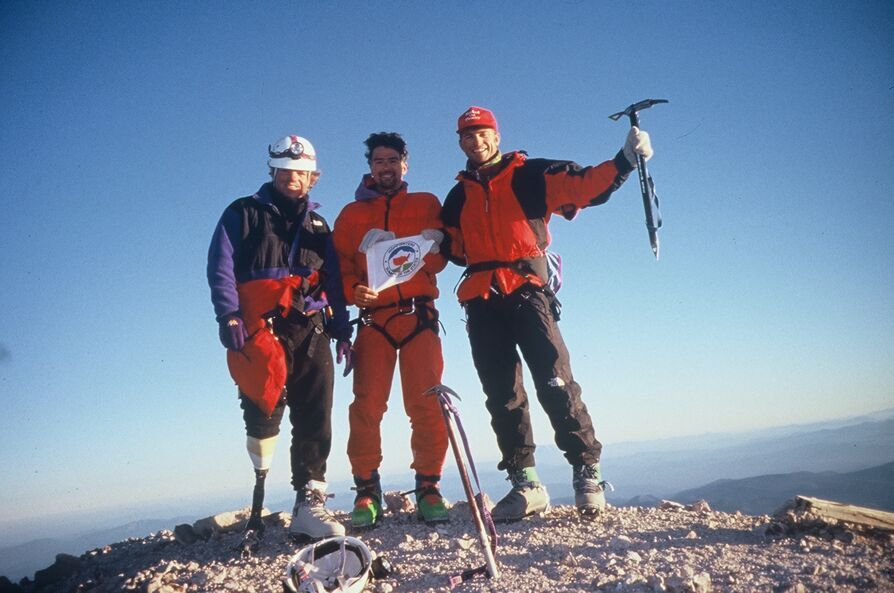
The clock was ticking. My flight back to Reno was leaving within hours of our summit. Once I got Todd and Whit got off the snow, I ran ahead and down the mountain to the Timberline Lodge to pack up our gear. Lisa and I loaded the truck and she revved the engine, urging Todd and Whit to hurry. They jumped in and we were off. Lisa had been tasked with getting me to the airport on time, and she took the challenge to heart, weaving the big red Ford pickup truck meticulously through the winding country roads. As we screeched to a halt in front of the airport, I said goodbye and wished Todd good luck, and then I ran for the gate. I arrived minutes before the flight took off, and was at work the next day.
Todd successfully completed his “Summit America” project on the summit of Mauna Kea, Hawaii on August 7th, setting a new record of 66 days, 22 hours and 47 minutes. He became the first and only disabled person to break and hold an able-bodied world record. This opened the door for him to receive exposure in global media and thousands of publications, including Sports Illustrated and all of the major television networks. CBS did a story on him ten minutes before the Super Bowl, which was seen by tens of millions of people. Todd has numerous awards including having been named on the list of Ten Outstanding Young Americans (along with Peyton Manning). He has spoken at the Sydney Opera House, and has met with prime ministers and kings. A movie is currently in the works about his life and the “Summit America” project.
I was—and I remain—proud of Todd, and happy to have been able to help him achieve his goal. Since high school, Todd and I have been together through a lot of ups and downs in life. This was by far the best “Up”!
To listen to Todd’s TEDx talk
Check out Todd’s website : www.toddhuston.com
Trip Report #9 – Running in the Kingdom of the Thunder Dragon: The First Bhutan Marathon
In August 2002, my wife Deb and I had just gotten home from a trip to Europe. The following weekend, we were at our local running store in Reno, Eclipse Running, and I saw a flyer advertising the first-ever Bhutan International Marathon. It featured a picture of the Himalayas. Needless to say, I was interested. Very interested.
When I showed Deb the flyer, she said something along the lines of “We just got home; I haven’t even gotten the laundry done from Europe!” I checked the date of the race and asked her if she could get caught up on the laundry by November 13th. Ultimately, we decided to check it out.
The website on the flyer led us to a guy named Rick who was based in Portland. He was with a cycling company called Rose Pedal, Inc. who were working with Nima Tours & Treks in Bhutan. He was a cyclist himself, involved with the Bhutan Olympic Committee, and was working to bring 350 foreign runners to the race. He was helping to arrange visas, transportation, and other logistics. When we told him Deb wouldn’t be running the race (this pre-dates her marathon running), he asked if she’d like to borrow his bike and ride the course. She took him up on his offer, and we were going!
To fly to Bhutan (at least back in 2002) the only airline option was Druk Air, the national airline, whose planes were also the method of transportation used by the royal family and government officials. We flew to Bangkok and spent a couple of days sightseeing and then caught our flight to Bhutan.
Flying in and seeing the profile of the Himalayas was so exciting. When we landed, we were met at the airport by a driver and guide who had been assigned to be with us for the entire trip. They gave us white prayer scarves and t-shirts with the race logo and welcomed us to Bhutan. Then, they took us to our hotel, where we met Rick.
We had a couple days of sightseeing in the area around Thimphu, the capital. We visited the Tiger’s Nest Monastery and other traditional Bhutanese fortified buildings, known as Dzongs. We also spent some time hiking and watching Olympic athletes in an archery competition in the National Stadium. During this time, we also had a chance to meet the other foreigners who were running the race, as well as a few local athletes.
The day before the marathon, the local running community hosted a Friendship Run 5K in Thimphu. Deb ran, and because I was running a marathon the next day, I just jogged with her. The altitude was noticeable. The average altitude for the marathon (as I learned that morning) was 2300 meters—about 7500 feet.
Race morning was spectacular. I will never forget it. It was the perfect combination of pre-race excitement, high altitude scenery, Himalayan culture, and nervous anticipation. We assembled at the start line near the town of Paro before sunrise. The race organizers had arranged a Buddhist puja ceremony to bless the race and bring safety and success to the runners. In addition to the prayers and the burning of branches, there were monks who played traditional instruments like drums and horns.
The course was challenging but beautiful. While the contestants ran, Deb rode Rick’s bike and took pictures of the scenery, the runners, and locals cheering us on from the sides of mountain roads. With permission of the race organizers, Deb’s bicycle had a basket full of water bottles, and she was basically a mobile aid-station for a lot of thirsty runners along the course.
Running into Thimpu, there were some young Bhutanese runners in front of me. They were Olympic hopefuls that I had met the day before, all of whom were really nice guys. I had joked with them at the Friendship Run that since I was old enough to be their father and since I only live and train at 1500 meters that they better finish in front of this old man. Three of them did. I was fourth overall and the first foreign runner. It was a great finish because Deb had the whole crowd yelling “FRED!” as I came to the finish line. After I finished, they gave both Deb and me medals, and brought me a chair and a bottle of water. It was first-class service.
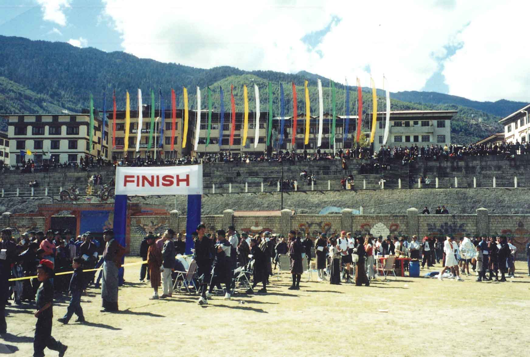
Later that night there was an awards ceremony and dinner with the Olympic hopefuls, the foreign runners, an Ambassador, members of the Olympic committee and the Director of Tourism. They presented all of the international runners with traditional Bhutanese dress: a gho for each man and a kira for each woman. With everyone wearing ghos and kiras, we had a huge dinner and a bonfire with singing and traditional dancing.
After the race, we stayed in Bhutan for another couple of days, doing more sightseeing and hiking, before going back to Bangkok for our last days of vacation.
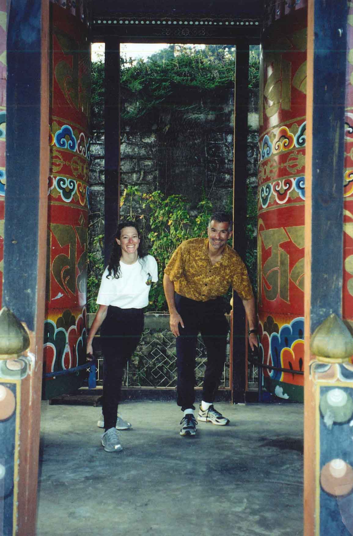
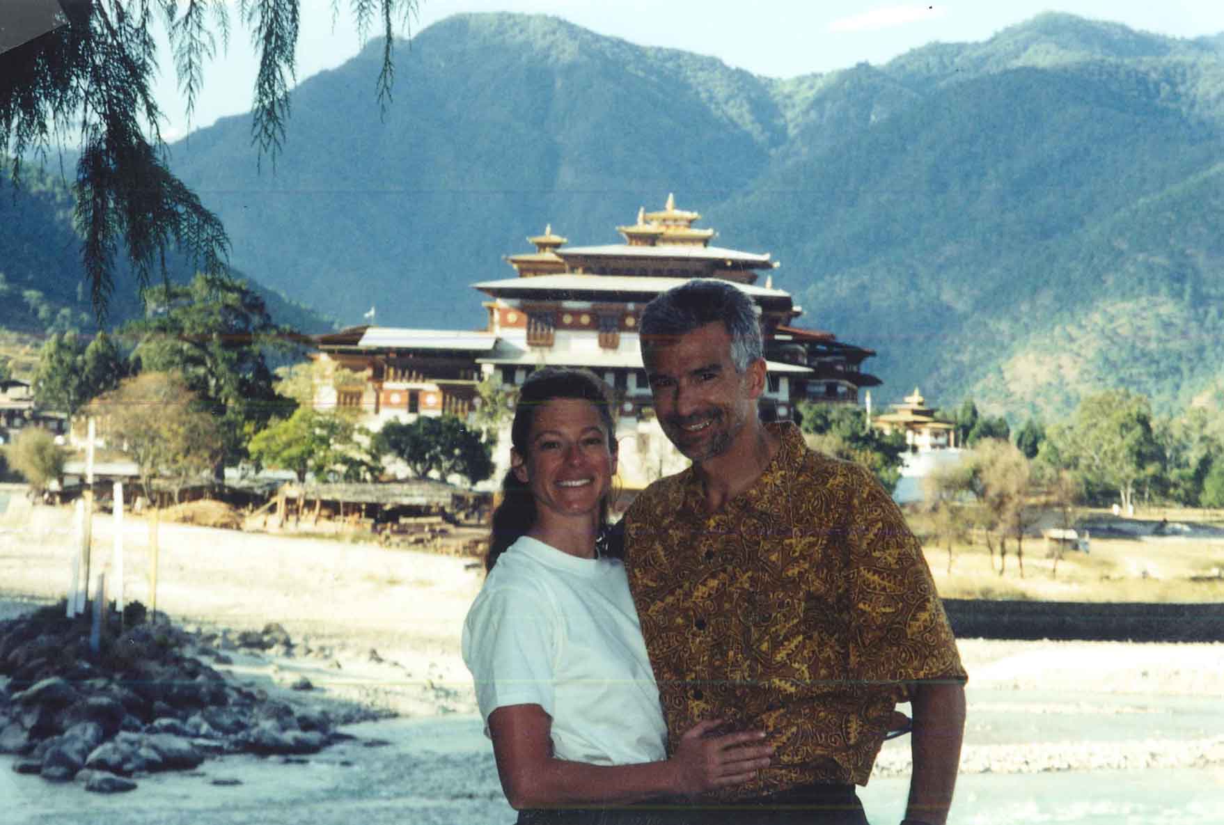
Visiting the Himalayan Kingdom of Bhutan was a great experience. Running the first marathon in Bhutan was a worthy and memorable challenge. But hands down, participating in and experiencing the Bhutanese culture was the best part of the trip. It was an unforgettable, once-in-a-lifetime experience.
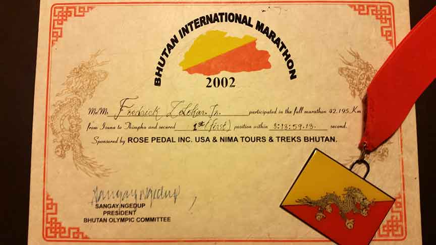
Trip Report #8 – Aconcagua
In December 1991, the highest I had ever climbed was the summit of El Pico de Orizaba, the high point of Mexico, at 18,700 ft. My new goal was to summit Aconcagua in Argentina. At a height of 22,841 ft, Aconcagua is the highest mountain outside of the Himalayas. Our expedition party was made up of my friend Sean (with whom I had climbed Orizaba) and his friend Brian.
We arrived in Mendoza, Argentina on Monday, December 23rd. Our plan was to spend two nights in Mendoza, at the Hotel Argentina. After we checked in at the hotel, we went to get our climbing permits at the Office of Tourism, which was close to the hotel. We each paid $80 (USD) for our permits. Interestingly, the high season summit permit now costs ten times that! The weather was beautiful: sunny and in the nineties. We had dinner outside at an Italian restaurant and afterwards, we went to bed.
The next day we went shopping for food and gas for our stoves—the usual pre-climb preparations. We organized and packed for the climb, and then we bought our bus ticket to Puente del Inca. We explored Mendoza a little bit and then rested and ate, getting ready to head out the next day. On Christmas Day we left Mendoza (2000 ft) and arrived at Puente del Inca (9000 ft). It was snowing at Puente del Inca, but we weren’t going to let that stop us.
At Puente del Inca, we arranged to have mules carry half of our gear to base camp, which was at Plaza de Mulas. After making arrangements for the mules, the three of us caught a bus that was headed all the way to Chile; it dropped us off 4 miles up the road, at the beginning of the trail leading to Plaza de Mulas. Base camp was about 30 miles from where we got dropped off. We hiked in to just past Confluencia (about 10 miles) and spent the night. Even after sending some of our gear up with the mules, our packs were still fairly heavy; mine weighed 55 lbs. It was still snowing, so we didn’t have a view of Aconcagua (or anything else, for that matter). We ate and went to bed.
The next day was the first full day of our expedition. We woke up to great weather. It had stopped snowing during the night, and we had an amazing view of the south face of Aconcagua. We were pumped up and ready to go. After breakfast, we broke down camp and started the 20 mile hike to Plaza de Mulas (14,100 ft).
We arrived at base camp at 4 PM. We were surprised to see a huge lodge under construction at Plaza de Mulas. It looked like it was almost finished being built, but they told us that it wouldn’t be officially open full-time until the next climbing season. They did serve lunch and dinner, and sold ham sandwiches, snacks and drinks all day long. Brian, being a purist, didn’t want anything to do with the lodge. We had planned to climb without a lodge, so we decided not to use the lodge, or take any food from there. Instead, we found a good spot, set up camp, ate, and went to bed.
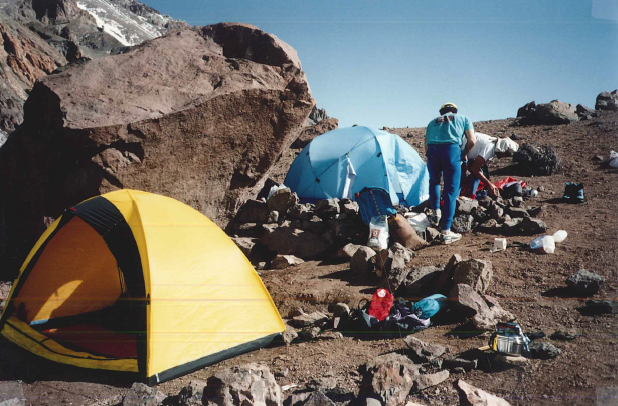
We woke to another beautiful, sunny day and planned to do a little altitude training. We hiked to Camp Pendiente (17,400 ft), had lunch, and ran back to base camp, where we just hung out and relaxed for the rest of the day. The next morning, the weather was not as good as it had been the day before. It was partly sunny, snowing a little, and windier. Our plan was to start our ascent. Sean and Brian decided to carry partial loads up to Camp Pendiente and descend to sleep at Plaza de Mulas. I chose to take my whole load to Camp Pendiente and sleep there.
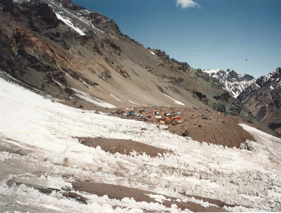
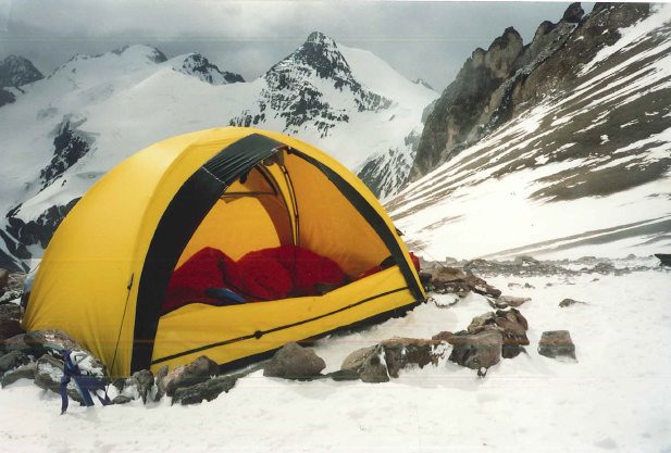
When I woke up on Sunday the weather was mixed, so I decided to move up the mountain to Nido de Condores at 18,200 ft, taking all my gear with me. By the time I arrived at Nido de Condores, the weather had deteriorated. It was a real struggle to set up my tent in the wind and snow. I didn’t see Sean or Brian that day. I stayed in my tent the rest of the day and listened to my tent flapping in the wind all night long.
The next morning the weather had taken a turn for the worse. It was still snowing, and even windier. I was getting very hungry, and pretty tired of my freeze-dried food. I started thinking about the new lodge at Plaza de Mulas, and about the food there. I decided I was going to the lodge. I left almost everything in my tent at Nido de Condores and arrived at our base camp at noon.
I caught up with Sean and Brian and told them I was going to the lodge to eat. (I thought it would be rude to eat first without letting them know.) Brian wasn’t interested, but Sean went with me. We got to the lodge just before 1:00 PM, which was great timing because they were just about to start serving lunch. We had as much as we wanted; soup, bread, pasta, meat and dessert! It was awesome.
The weather was still bad, so I decided to spend the rest of the day out of the elements, in the lodge. My original plan had been to descend to the lodge, eat, and go back up to Nido de Condores to sleep in my tent. I decided sleeping in the lodge was a better idea. Sean agreed. He went back to our base camp to let Brian know, and to pick up a few things. I stayed at the lodge, hung out, ate a ham sandwich and drank lots of sodas. Sean and a reluctant Brian showed up a little before 5:30, ready for dinner and a good night’s sleep. Dinner was at 8:30, and it was great!
We woke up on New Year’s Eve and had a continental breakfast. Sean and I each took two ham sandwiches to go (Brian didn’t want any) and even though it was still snowing and windy, the three of us decided to go up to Nido de Condores. We went back to our base camp, and Sean and Brian packed up their stuff. My pack was very light, since nearly all my gear was already up the mountain. Sean and Brian carried partial loads to Camp Pendiente, where they picked up the supplies they had left there on the 28th.
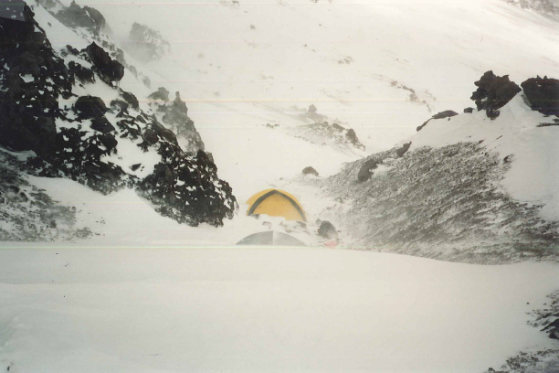
When we arrived at Nido de Condores, the weather was bad: snowing and windy. This wasn’t a problem for me, because my tent was already set up right where I’d left it. Sean and Brian struggled to set up their tent, but they got it done. Later, when they were in their tent and I was in mine, I was getting ready to eat. Out of nowhere, three climbers appeared at my tent and invited themselves in, saying that there was an emergency and they needed to stay in my tent. I let them in and told them that they needed to put their tent up. They said it was not possible because of the weather. I told them that we had just put up the tent next to me (Sean and Brian’s). They didn’t show any signs of wanting to go put up their tent. Frustrated, I took their tent, went out into the snow and wind, and started setting it up myself. When I was nearly done, the guy who seemed like their leader came out and helped me finish. When the tent was done, the other 2 came out of my tent and that was the last I saw of them. Finally alone, I ate a ham sandwich and went to bed.
The next day was New Year’s Day, 1992! No college football for me. I spent the day in my tent, watching the snow and listening to the wind. When there were breaks in the weather, I went outside a little bit at a time; maybe a total of an hour outside my tent all day. I went to bed, hoping tomorrow would be a better day.
Lo and behold, it was! When I woke up, it was partly cloudy but not snowing, and there was much less wind. I decided to make a summit attempt from Nido de Condores. I told Sean and Brian that I was heading up to check things out in about an hour. Sean knew exactly what that meant: going to the top if all possible. He said he’d be going. Brian said he didn’t feel like going so he stayed at the tent. I started up a little before Sean, but we met up at Camp Berlin, the next camp up the mountain (19,450 ft.)
There were a dozen people at Berlin, but they had decided to wait and try the summit tomorrow. Above Berlin, Sean and I were alone on the mountain, just the way we liked it. The route was easy to follow, and there wasn’t much snow. I guess the wind had blown it away.
At the bottom of La Canaleta, we ran into 3 Japanese climbers. They had abandoned their summit attempt and were sitting on the ground (in the snow), smoking cigarettes at 21,000 ft. Sean and I pushed to the summit, standing on the top of Aconcagua in the late afternoon of January 2nd. It was nearly 5 PM by the time we got to the top. We hung out, took pictures, and enjoyed the view. We headed down, and by the time we got to Berlin, it was starting to get dark.
When we got back to Berlin, there were about 50 people there. With the better weather, they had all moved up the mountain to Berlin, with a plan to go to the summit the next day. It was like a little village. Since we were the only ones to summit that day, everyone wanted to talk to us. Sean took off and headed down to Nido de Condores, but I hung out, had a drink, and answered questions about the conditions above.
It was dark by the time I left Berlin, so I wandered off the trail a bit. In the dark, I nearly walked off the edge of a cliff. When I realized that the edge of the cliff was nearly under me, I grabbed a rock formation to try to steady myself and keep from going over. I was able to stop myself, but I watched my red Marmot Snow Goose sleeping bag sail away and disappear into the darkness of the abyss. I still miss that bag.
I knew that I needed to find my tent. Of course, I headed away from the cliff. In the distance, I could see a light. Soon, I realized that the light was in fact, a tent, and I continued to head towards it.
When I finally got to the tent, I said “Hello?” Four Japanese women inside unzipped the tent and invited me in. They didn’t speak much English, but were unbelievably nice to me! They fed me, offered me plenty to drink, and we all spent the better part of the night talking with our hands. They re-arranged their sleeping bags and let me spend the night in their tent.
At first light, I looked outside. It was a glorious day: blue sky and no wind. It was only then that I realized that I was at Camp Pendiente! I said my goodbyes, and headed back up the mountain to Nido de Condores. When I got there, I yelled to Sean that I was back, and went into my tent and started packing up my stuff.
About an hour later, I got together with Sean. He asked what I had meant when I yelled that I was “back”. I laid it on thick about spending the night in a tent with four Japanese ladies at Camp Pendiente. I didn’t know if he believed me or not, but I knew we’d run into them on our way down. Sean and I were heading down to Plaza de Mulas, and Brian had decided to stay at Nido de Condores and make a summit attempt the next day. On the way down, we ran into my friends from the night before, which validated my story. We got down to the lodge just in time for lunch!
Since Brian was making a summit attempt the next day, Sean decided that he would run up to the summit from Plaza de Mulas, taking a shot at the mountain’s speed ascent record. I decided that chilling out at the lodge and eating good food was a better plan. Sean and I spent the night in the lodge.
On the morning of January 4th, Sean took off running up the mountain. I wished him luck and went to breakfast. Around 2 PM, Sean and Brian got back to Plaza de Mulas. Neither had been successful in reaching the top. I said, “Let’s get out of here,” and Sean agreed. Brian decided to stay another night, and Sean and I started preparing to leave. We made arrangements for the mules to carry all of our gear. The mule wangler told us that it was too late in the day for us to get to Puente del Inca. We asked if the mules could make it, and he said “No problem.” We told him that we could do it in under 4 hours. He took our money and said “okay”. I’m pretty sure he didn’t believe us, but we ran alongside them and kept them in sight most of the way.
4 or 5 miles before Puente del Inca, a pickup truck drove towards us. The mule wrangler took our bags off the mules and threw them in the back of the truck and then we got in the back, too. We bounced along the dirt road until we got to the paved road that took us to Puente del Inca. We got dropped off at the hotel in Puente del Inca. We got the last room available for the night, had a big dinner, and went to bed.
After we checked out of the hotel the next morning, we explored the ruins of the Incan Baths and took the bus to Mendoza. Brian arrived in Mendoza 2 days later.
My Aconcagua climb was the first of many trips to South America, as well as being the first successful attempt at one of the Seven Summits. I found the Aconcagua area beautiful and easily accessible. The climb, via the Normal Route, is not technical, so the biggest challenge is successfully handling the altitude. For all of these reasons, I highly recommend an Aconcagua climb as a goal for aspiring mountaineers.
TRIP REPORT #7 – The Sands of Namibia
In the summer of 2015, my wife Deb and I were planning our next adventure. I was looking for a new country, an interesting high point, and a trip that would be outdoors-oriented. Deb was interested in wildlife viewing, and she suggested we find somewhere in Africa. We decided a trip to Namibia would tick all the boxes.
In June, we flew to Windhoek and rented a car. For the most part, Namibia’s road system is very good, and I was looking forward to driving all over the country. We headed to Sossusvlei, a part of Namibia that has huge, beautiful sand dunes bordering something called the Dead Vlei, where the skeletons of dead trees are scattered on a pan of dried mud.
We stayed at Sossus Dune Lodge, in the park. After checking in, we went out and climbed one of the sand dunes, Dune 45, before having dinner and going to bed. We got up early the next morning and headed to the trailhead to hike in to “Big Daddy,” the tallest dune in the area, which is adjacent to the Dead Vlei. We started hiking in the dark, and were on top of the dune before the sunrise. When the sun came up, the view was spectacular. Then we ran down the back side of the dune, skating and sinking through the sand, right into the Dead Vlei. Walking through the dead trees in the pan was surreal, like being on another planet, with the red dunes rising up on all sides. We were there so early that we had the whole pan to ourselves for a little while, just sharing it with a couple of indigenous oryx called gemsbok, before the other tourists appeared.
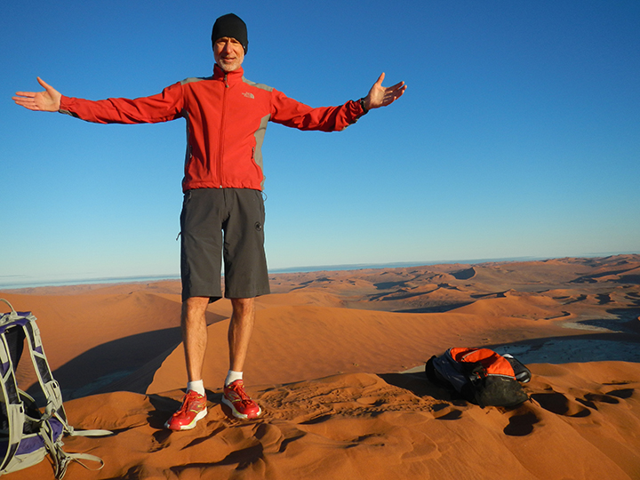
We headed north, to the coast to Swakopmund. On the way, we stopped for gas and the best apple pie that I’ve ever had, in Solitaire.
In Swakopmund, we explored the coast with a guy who drove us over the sand in a Land Rover, and took us to a place where we climbed a nearly vertical dune overlooking the ocean. He drove the vehicle up the other (more gentle) side of the dune and we picnicked on top of the dune, with the best lunch view in the country. On the drive down, we bounced and slid through the sand.
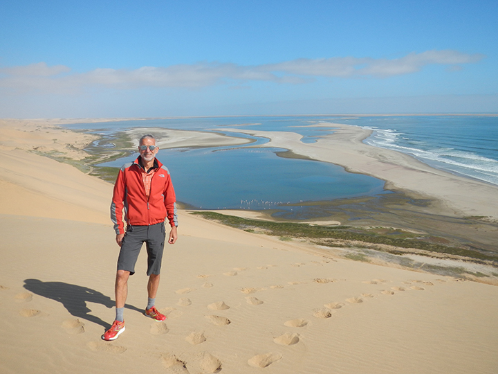
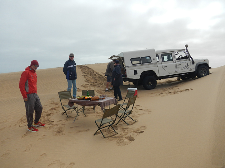
The next day, we went on a three-hour flight in a six-seater plane (two pilots and four passengers) over the dunes and along the famous Skeleton Coast. From the air, we could see all the different colors in the dunes—red, yellow, gold and white—and thousands of cape fur seals lying on the beach. We flew over the remains of old diamond mines, which were almost buried in the sand, as well as two shipwrecks. Over time, the shipwrecks had started slowly moving inland, as the sand from the dunes is gradually expanding the shoreline out into the ocean. It was a beautiful, breathtaking experience unlike anything we’d ever seen.
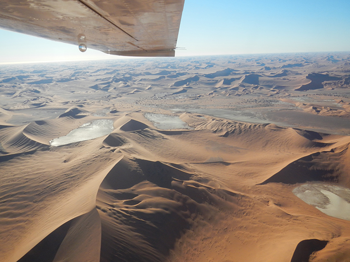
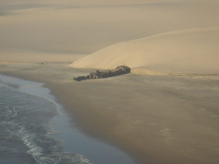
After the aerial tour, we continued north to Uis. Our destination was the Brandberg Rest Camp, owned and managed by a man named Basil Calitz. I had talked with Basil online prior to our arrival, and he had taken care of all of the paperwork to arrange my climbing permit through the National Parks service for the Brandberg (Burnt Mountain), the high point of Namibia. The Brandberg’s highest peak is Konigstein, at 8550 feet. Typically people spend three days and two nights in order to summit Konigstein. They hike to a camp, spend the night, summit the mountain the second day, and return to spend the second night at the same camp. They descend on the third day.
Naturally, I was not interested in spending three whole vacation days climbing a 8550-foot peak that required no technical skills.
So in corresponding with Basil, I had asked him if I could go up and down in a day. He was a little skeptical, but said he would set me up with the fittest guide he could find, who would be best suited to round-trip it in a single day. (I tried to convince him that I could do the climb without a guide, but because of the National Park rules, that was not going to happen!)
After we checked in at the Rest Camp and met Basil, we drove to the park office to pick up my permit. While we were there we hiked into the park to see “The White Lady of Brandberg,” a famous rock painting.
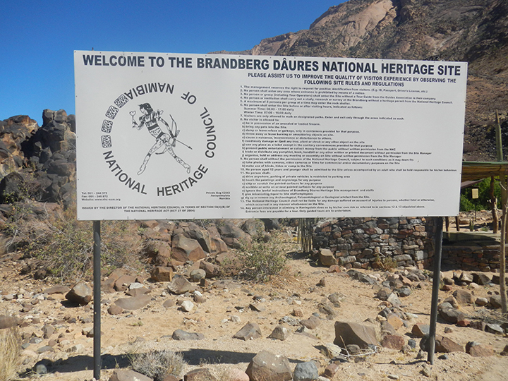

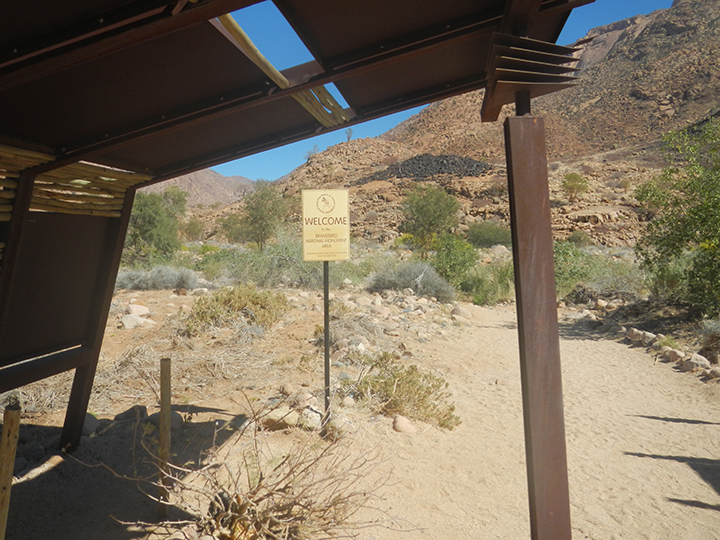
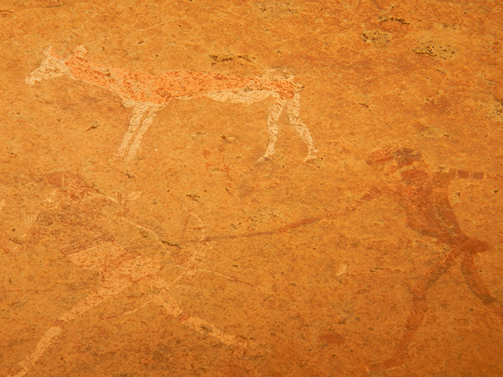
The next morning, we had breakfast with Basil. My guide, John Taniseh, met up with us at the hotel. After breakfast, Basil, Deb, John and I drove to the trailhead. John and I started our climb. While John and I climbed, Basil and Deb drove all over the area, looking at geological sites and watching for wildlife, having a picnic lunch outside with zebras looking on.
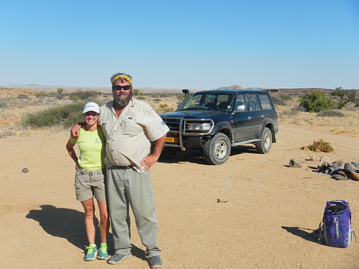
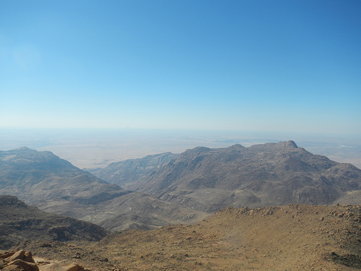
The climb was straightforward, and relatively easy. The trail was well marked, and it was a beautiful day. John initially seemed skeptical about the single-day expedition, but I let him set the pace, and we were on the summit in about 4 hours. We spent about half an hour on top, and then headed back down. When we arrived at the trailhead, Deb and Basil were waiting for us. They’d set up an outdoor barbecue, called a braai; they were already grilling steaks and had cold beers ready for us! Basil shook my hand, and congratulated me. Unbeknownst to me, he had started his watch when we began our ascent, and he told me that he clocked us at 8 hours and 6 minutes round-trip. He informed me that this was a new record. I thought to myself that if I’d known I was trying to establish a record, I wouldn’t have hung out for half an hour eating lunch and taking pictures, and I would have run the downhills!
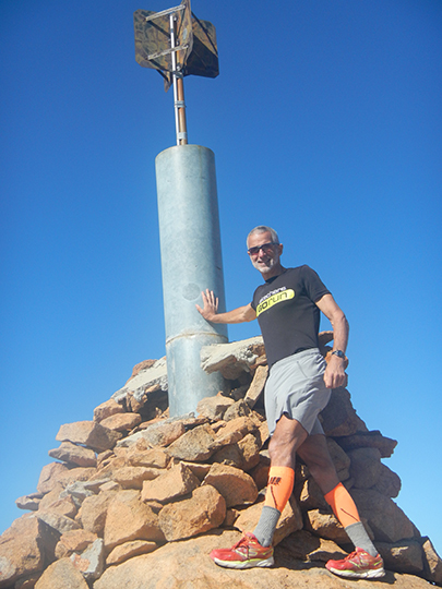
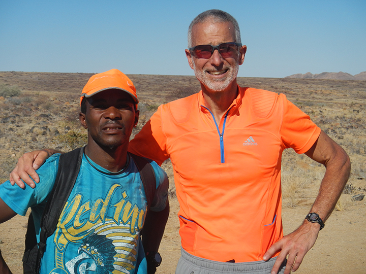
That night at dinner, Basil presented me with a framed photo of John and me with the date, and our record-setting time printed on it. He hung a copy in the hotel bar, and he had one made for John, too. That picture hangs in my office now. It was such a thoughtful gesture, and I could tell that he was really proud to have been a part of our expedition.
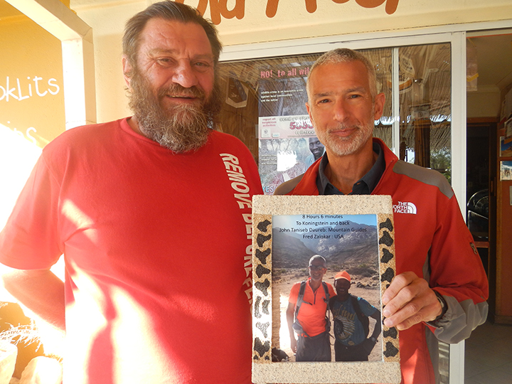
Our next destination was Etosha National Park, further north. We stayed at Okaukuejo Rest Camp, in the park. This allowed us to sit outside at the watering holes after dark, which was an incredible opportunity to see wildlife. One night we saw three rhinos and seven elephants at once, all sharing the watering hole with zebras, antelopes, and giraffes. During the day, we drove through the park, stopping at watering holes or just pulling over to the side of the road, watching lions, rhinos, giraffes, warthogs, elephants, ostriches, cape buffalo, wildebeest, hartebeest, impala, springbok and gemsbok. My favorite thing about Etosha compared to other African wildlife parks that I have visited, was that we had complete autonomy; we could drive ourselves everywhere. The only rule was “Don’t get out of your car!” It’s a good rule, and we were happy to follow it!
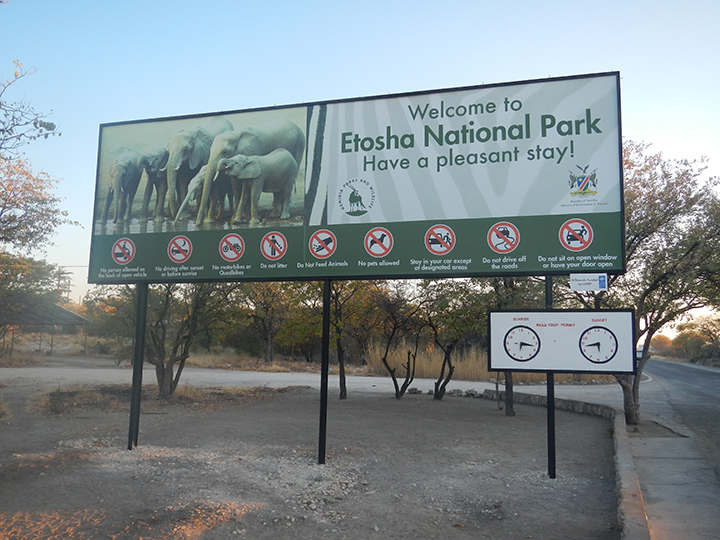
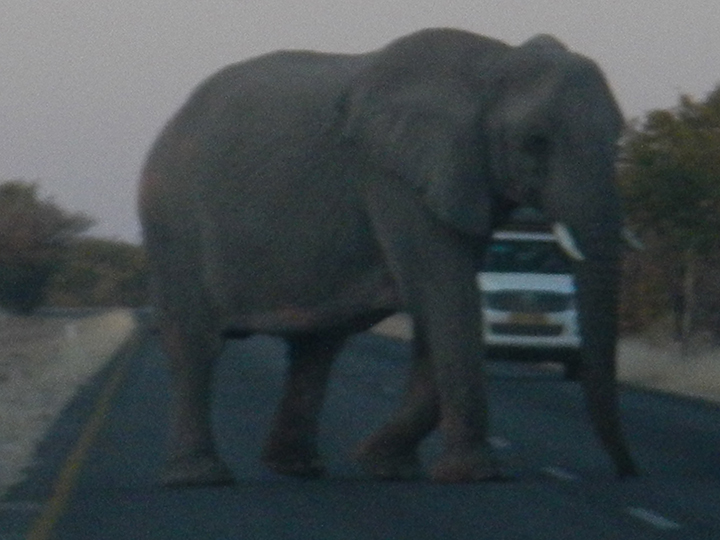
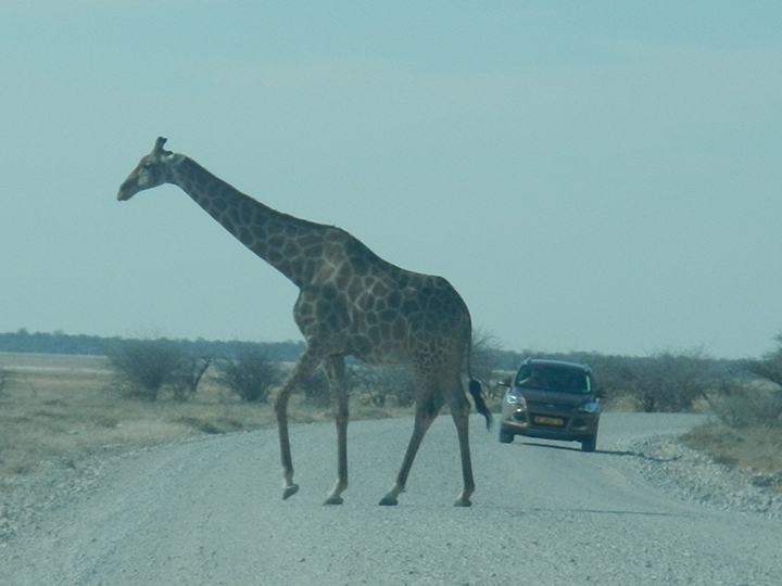
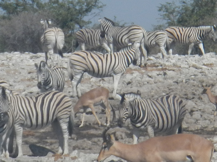
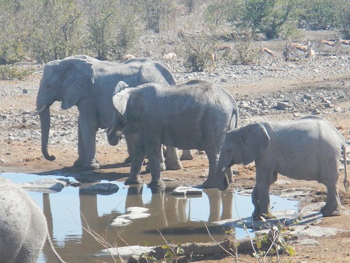
When we left Etosha, we headed back to Windhoek. While I was checking in at the hotel, Deb was walking around the lobby and started flipping through the newspapers, many of which were in Afrikaans. Behind my back, I heard her start laughing, and she said, “Hey, Fred…”.
On the front page of a Namibian newspaper called the “Republikein” was a picture (taken by Basil) of John and me! The article was in Afrikaans, and was titled “Amerikaner Klim Brandberg in Rekordtyd” (American Climbs Brandberg in Record Time). We showed the picture to the guy at the hotel’s front desk, and he was pretty impressed. He shook my hand, read us the article (translating it into English), and let us keep the paper!
Later that day when we went into town to eat and do a little souvenir shopping, we were in a grocery store, and we saw a rack of the “Republikeins”. The next day in the airport, 2 different men came up to me, and asked me if I was the American from the paper. They shook my hand, and congratulated me. I felt like climbing royalty. That newspaper front-page is one of my all-time favorite souvenirs!
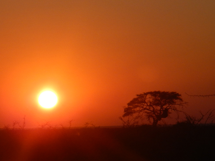
Trip Report #6 – 9 Races, 7 Years, 6 Age-Group Wins: Running the Abbott World Marathon Majors
While I was following my goal to run a marathon on each of the seven continents, my wife Deb started running marathons as well. Deb decided that she wanted to qualify for, and run, the Boston Marathon. At the time, that didn’t sound interesting to me at all. She ran Boston in 2009, with a friend, and I stayed home.
When she came back from Boston, Deb changed tactics. She told me about the Marathon Majors—Boston, New York, Chicago, London, and Berlin—and said that her new goal was to run these five races. Specifically, she started trying to get me interested in running the Berlin Marathon, knowing that I had traveled extensively through Germany but had never been to Berlin. It was a flat, fast course, she said, unlike Boston. I would be 50 the following year; maybe I could run a marathon PR at age 50 in Berlin?
I started to give the matter some thought.
I committed to running the 2010 Berlin Marathon, and we both registered. As part of my training, I started to make some adjustments to my running. I changed my running mechanics from being a heel striker to a midfoot-striker, switching my shoes to facilitate that change. I also started to focus on dropping weight. These changes made a big difference in my training for Berlin. I averaged between 125 and 140 miles a week for three months, but I was much less sore than I had been previously, even when I’d been running lower mileage.
When I got to Berlin, I was ready. We had a few days of sightseeing (in the rain) leading up to the race. On race morning, it was still raining, and it rained for the entire race. There was nothing I could do about the weather, so after the first couple of miles, I just relaxed and ignored it. The course was as flat as I had hoped, and I ran well. I ran a 2:37:03, and surprisingly won my age-group (which, at the time, was Men’s 50-54.) I was hooked.
Actually, I’m still hooked. I haven’t really slowed down since Berlin.
Eating a pretzel after the race, I told Deb that my new goal was to run all 5 Marathon Majors. She was psyched; we were going back to Boston.
We went to Boston in 2011. Boston is a much hillier course than Berlin, so I adjusted my training accordingly. I ran more downhills and did my treadmill workouts with a downhill grade. I averaged 140 to 150 miles per week for 3 months. With the hills on the course, I didn’t expect to run a fast time; I was focused on trying to win my age-group. As it turned out, I ran a personal record that day: a 2:34:46. And I did win my age-group. The awards ceremony after the race was fun, and it was cool to stand next to, and meet, Joan Benoit-Samuelson, who had won the Women’s 50-54s.
The next stop was New York. That was a tough race. Although my training for New York was similar to my training for Boston, I wasn’t feeling 100% on race day. I had an injury on the bottom of my right foot, and while I was able to run well for the first 10K, the rest of the race was not good. I finished in 14th place in my age group, with one of my slowest times ever: a 2:50:44. I knew I could do better, and I wasn’t happy with my time or my place. In the back of my head, I thought that someday I’d like to go back for another shot at it. Not right away though, because I was already committed to run London in April of 2012 and Chicago that fall.
London, like Berlin, is a flat course, so I adjusted my training. I focused on turnover and flat training runs, running 140 to150 miles per week for 3 months. I ran decently, and I was 3rd in my age group with a 2:37:35. That took some of the sting out of my New York race, but I knew I could do better. I was going to figure some things out and make some changes in the 6 months between London and Chicago.
I got my foot completely healed and added more speed work to my training. Chicago is a flat course, so I continued training fast and flat, focusing on turnover. I dropped a few more pounds, too. I was healthy, I was well trained, and I was incredibly focused mentally. I wanted to run fast, and I wanted that age-group win. I was able to accomplish both. I won my age-group with a 2:35:10, and was 5th Masters overall. I was happy.
The Marathon Majors had been a worthwhile goal. I had actually enjoyed being part of the large fields (with more than 40,000 runners) and the excitement that the Majors conjured up. I had challenged myself, facing the challenges that the individual courses had offered, while maintaining a high level of training and mileage from 2010 to 2012. I had picked up 3 out of 5 age-group wins, and been on the podium 4 out of 5 times, facing some of the toughest age-group competitors at the marathon distance in the world. I was ready for some shorter distances, and at this point, I started running more half marathons.
In February of 2013, Deb and I were watching coverage of the Tokyo Marathon on TV. The commentators casually mentioned that Tokyo had recently been added to Berlin, London, New York, Boston and Chicago to form what was now being called The Abbott World Marathon Majors.
I looked at Deb.
Deb looked at me.
Deb started laughing uncontrollably. When I asked her why she was laughing, she just said, “I’m going to Tokyo.” I said, “That can’t be right. They can’t just add a race. There were 5. I ran 5.” Again she said, “We’re going to Tokyo.” I was still unconvinced, so I said, “Google it.” She did. The Tokyo Marathon had, in fact, been made one of the Majors. We were going to Tokyo.
I had a lot of time to get ready for Tokyo since it wasn’t following on the heels of another marathon. I did my standard 3 months of training, averaging between 160 and 170 miles a week, focusing on running flat and fast. One week, just for the heck of it, I ran 200 miles. I dropped a couple more pounds.
Tokyo is not like the other Abbott World Marathon Majors. In 2014, faster runners were not seeded in the front of the race, the way they are elsewhere. The elites were on the start line. Then they were followed by the Japanese Athletics Federation in the next corral. There are no time requirements to be in this corral, and in addition to faster Japanese runners, it is also the starting corral for many people dressed in costumes, and other, slower runners. I was behind them.
This was bad. It was very frustrating to zigzag through runners dressed as Minnie Mouse, runners holding hands, and runners who stopped and stood still to take pictures. This went on for the first 5K of the race. I know I wasted some significant energy there. The other consequences of this chaotic start became apparent later, when we learned that the official race results are based on gun time, not chip time.
Another difference between Tokyo and the other Abbott World Marathon Majors is the availability of race results. All of the other races post results online by the end of race day. For Tokyo, only our gun time was available. No age-group or other place information. We had the concierge at our hotel call the race office after a few days, to see if we could get official results; we were told that race results would be sent to us by mail. So, with not much choice in the matter, we waited.
We waited over a month. Finally, our certificates arrived in the mail. My official finish time was 2:41:29. My net time (listed separately on the certificate) was 2:40:35. My place was 2nd in my age-group. I went online to see how far in front of me the 1st place finisher was, and how far behind me the 3rd place finisher was, but nothing was online. To this day, I don’t know who beat me, and by how much time, or where he started. I also don’t know whether his net time was slower or faster than mine.
No matter; I had achieved my (revised) goal. I had run all 6 of the Abbott World Marathon Majors. I had won my age-group in 3, and been on the podium for 5 of the 6. I was ready to cross the Abbott World Marathon Majors off my list.
By 2015, my son Ian had started college at Columbia University in New York. Deb wanted to go visit and decided to remind me that I had unfinished business there. I had turned 55 in May. With 3 out of 6 age-group wins in Men’s 50-54, she reasoned, why not try to win the other 3 in Men’s 55-59? While part of me suspected that she was just looking for a family vacation in New York City, part of me liked the idea. I knew I could do better in New York. I was healthy. I was running well. I was at the bottom of a new age-group. My mom and sister said they would come to cheer me on, my kid was in New York, my wife wanted to go, and I wanted to kick off my new age-group with a big win.
The race was a lot better than the one in 2011 had been. Hearing my family cheering for me along the course was amazing. Deb and Ian were waiting for me on 5th Avenue at the entrance to Central Park; they had the cops running security detail yell “ZALOKAR!” for me as I went by. By this time, I was sponsored by Skechers Performance, so I was wearing a singlet that said “Skechers”, and strangers were yelling “Go Skechers Guy!” I ran a 2:43:10, and won my age-group. At dinner that night, I announced my new goal to my family: I was going to win my age-group in all 6 Abbott World Marathon Majors, 4 down, 2 to go. Somehow, nobody was surprised.

When I got home, I started researching to see if anyone had won their age-group in all 6 races. It didn’t appear that anyone had. That made the goal even more enticing. Could I be the first person to do it?
I had London and Tokyo to choose from. I’d had a much better race experience in London, and Deb hadn’t run London in 2012 when I did, so she was excited to go and get her 6-Star Finisher status at the Abbott World Marathon Majors. London, 2016: we had a plan. I was healthy and able to put in 3 months of good high mileage training before the race. I felt strong during the race, was familiar with the course and was focused on that age-group win. I got it, running a 2:39:50, 5 out of 6.
Only Tokyo stood between me and my goal. I was a little apprehensive about running Tokyo again, because of the (in my opinion) poorly managed start, and also because I felt that the official results being based on gun time, rather than chip time, did not work in my favor. But, I was 5 for 6, and Tokyo was number 6. There was no getting around it. Fortunately, in the 3 years since I had run the race, Tokyo had slightly restructured their start line and corral set up. With a qualifying time, I was able to apply for an Overseas Semi-Elite position, which would put me in a corral directly behind the elite runners. I applied and got the position. I was cautiously optimistic. On race day, my position was exactly as I had been told it would be, which was really important because the race still used the gun time for their race results.
The race wasn’t easy, but I stayed focused on my splits, and they were OK. I wanted to win my age-group. I wanted to be done. At this point, I didn’t want to run this race again. With about a mile and a half to go, I tucked in behind an elite woman and decided no one was going to pass me. She and I passed at least a dozen runners in that last stretch. I finished the race in 2:45:42 (chip time), only 6 seconds off my official race time of 2:45:48. I was so happy to have had that Semi-Elite starting position! Now, the only thing to do was wait to find out the age-group standings.
And we waited. Just like 2014, there was no placement information online, just my time and splits. Just for the heck of it, I sent an e-mail to the race and had the concierge call, but in both cases, we were told that no age-group place information was available. I really don’t understand the delay, but there was nothing to do but wait.
By the time we got home, there was still no information available. A day didn’t go by without multiple people asking Deb and me how I had done, and whether I had gotten that 6th win. We all waited. Eleven days later, official race results were posted online. I had won my age-group. YIPPEE-KI-YAY!! I won by less than a minute. Both 2nd and 3rd place in my age-group were Semi-Elite Japanese runners. Thank goodness I had the Overseas Semi-Elite entry. I e-mailed the race to ask about age-group awards. They e-mailed me back and said they didn’t give age-group awards, which is another way that Tokyo is different from the other 5 races.
Running all 6 Abbott World Marathon Majors and earning 6-Star Finisher status is a huge accomplishment. Winning my age-group in all 6 took a lot of hard work, and was exciting and challenging. Being the first to accomplish this Abbott World Marathon Majors Age-Group Sweep makes it even better.
Since Tokyo, I have been racing shorter distances, and my average weekly mileage is about 105 to 115. My next marathon is in April 2018, in Paris. I’ll turn 60 in 2020… that might be the time to revisit the Abbott World Marathon Majors circuit? Or maybe they’ll add another one? I wouldn’t mind running a marathon in Sydney…
Trip Report #5 – Run to the Top of Europe
In March 1992, I heard about an event called, “Run to the Top of Europe”. The flyer said that the previous summer, a group of runners had made a multi-day running ascent of Mt. Elbrus in Russia. In the summer of 1992, a second such attempt would be made. The flyer went on to say that “With the new spirit of co-operation beyond the spirit of glasnost, getting to and around the USSR is now much more possible for determined athletes. Any American runners who think they can handle the challenge are invited to participate.” When I read that, I thought, “I’m always up for a challenge!” I had been wanting to climb Mt. Elbrus, because it’s the high point of Europe, and this seemed like a great way to accomplish that.
The race was organized as a four-day stage race. The first stage was from Tynaus (1350m) to Elbrus (1650m). It was 42 kilometers (marathon distance), completely on pavement. The second stage was from Elbrus to Azau (2350m). It was 23 kilometers, also on pavement. The third stage was from Azau to Priyut II (4100m). It was 15 kilometers on a dirt mountain road. The final stage was from Priyut II to the top of Mt. Elbrus (5642m). That stage was on snow the entire way. I thought that this event was right up my alley, because I was a climber and a distance/mountain runner. I signed up for the event, and was accepted. The race was scheduled to begin on July 31st.
On July 27th, 1992, I left Reno and flew to London. I arrived mid-day on the 28th and spent the day sightseeing. On the 29th, I flew to Moscow, arriving late in the day. When I arrived, the weather was grey. The Moscow airport was like nowhere I had ever been before. It was a little surreal, arriving there alone, not speaking any Russian, and unable to read any of the signage, as it was all in Cyrillic. After going through immigration and customs, it took a while for me to locate the two guys who were there to meet me. They spoke broken English and took me to a very small, very old car. It was all a little like something out of a movie, and I briefly thought I might never be seen again! These thoughts vanished quickly when we arrived at the offices of the Adventure Club/Sputnik, the organizers of the race. I met my interpreter, as well as the race director and other Sputnik members. A group of us had supper, and then I was taken to a very basic dormitory-style hotel where I spent the night.
The next morning, I was taken back to the Sputnik office, where all of the race participants (about 25 of us) had breakfast together. There were 2 Americans, 6-8 Europeans, and the rest were Russian. We took a bus to a small, regional airport, Bykovo. The 35-kilometer ride was interesting. My impressions were that everything was square, and in disrepair. There were a lot of checkpoints along the road, but most were abandoned. Those that were manned, we stopped at, without incident.
When we got to the airport, I was told not to speak, and to stay with the group. I followed directions, and we cleared security as a group and went to the gate. It was a one-of-a-kind flying experience. As a group, we walked into the bottom of the plane, carrying our luggage, and stowed it on giant luggage racks. Then we climbed steep metal stairs to the upper level of the plane, where the seats were. We were told to just take any open seat. The cabin was worn, and in disrepair. Take-off was also interesting. The whole cabin shook, overhead compartments opened, luggage fell out, and unoccupied seats folded forward. The drink and snack service was on mismatched plastic plates and cups of different colors and sizes, with 2 or 3 drink choices. Again, it was surreal, like a scene from a movie, and completely different from anything I had ever experienced. We made it, though, and arrived at our destination, Mineralnye Vody, around noon. We waited for over 1 hour for our bus. On the way to the lodge, we stopped for supper. We arrived in Terskol around 7.
On the morning of the first stage, we had breakfast and then took a bus to the start line. The 42K course was on a paved road, and fairly flat, with a net gain of 300m. The race started at noon. It was raining at the start line, and it continued to rain the whole way. I won the stage, maybe because most of the participants were climbers, rather than runners. A few of us finished well ahead of the rest, and we cheered for the rest of the group as they finished. When the last runner finished, we took the bus back to the lodge in Terskol. We took saunas and had Russian massages. Another surreal experience: hanging out with sweaty, naked men and being whipped with tree branches. At supper, the race director announced the results of the day’s race.
The next day, the rain was gone, and the weather was good, but I felt a little sick, and was having some digestive issues. The race started at noon. The course was a 23K with a 700m net gain, on pavement. It started at the previous day’s finish, and ended at a ski resort. I was second. After lunch we stopped at a mineral water plant and went back to the lodge, where I had another massage. This time it was with the race’s doctor, and it was a much better experience. At supper, when the race results were announced, I learned that my second place finish was close enough to the winner to keep me in position as the overall race leader.
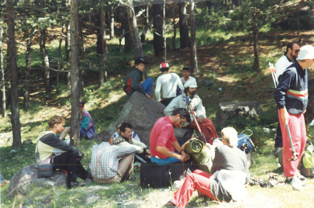
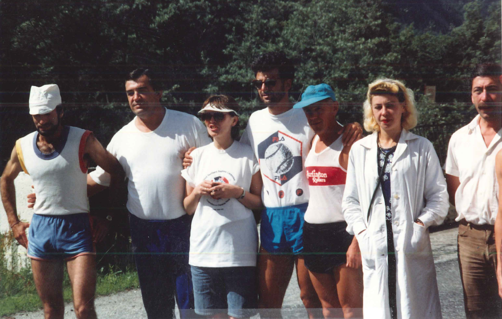
The day of the third stage, I still wasn’t feeling 100%. After breakfast, we packed our bags, because we were moving up the mountain to Priyut II, our next lodging, at 4100m. I called it “Camp Tin Cans” because the cabins looked like red and white cans lying on their sides. We went to the start with our bags and a tram took them to Priyut II for us while we went back to the lodge for lunch. The race started at 3 PM. The course was a 15K with a 1750m climb on a dirt road, starting at the previous day’s finish, and ending at Priyut II.
The camp at Priyut II was another thing about this trip that was unique. I’ve never (before or since) stayed in a camp with round tube-shaped cabins made of metal. It was another out of a movie moment. A unique thing about the camp was the outside toilets. They were a plywood box, almost hanging off the side of a cliff. They weren’t attended too very well, and they were pretty dirty and disgusting.
When the race started, my stomach was really hurting, and I fell back to last place. Midway through the race, I started to feel better, and stronger. I made a big push, and picked up the pace. I made up a lot of time, and was able to finish fourth. After 3 consecutive days of racing, I was second overall, and a few minutes behind the leader. With the next day scheduled as a rest day, I felt confident that I could make up the time on the last stage.
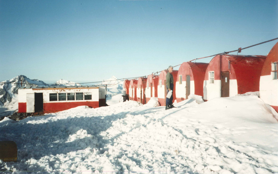
I was excited about climbing to the summit of Elbrus in 2 days. Looking up at the mountain from Priyut II, we could see the two summits: the closer, east summit and the higher, west summit. I asked the race director what route we were taking to the summit. This was the exact moment when I learned that the race finished on the top of the east summit, not on the “Top of Europe” which is the west summit. I was shocked, and in total disbelief. I said “The event is called “Run to the Top of Europe, which is the WEST summit.” He replied “What’s a few meters?” and shrugged. I was still stunned. This whole time (since March) I thought I was going to the Top of Europe, the west summit of Mt. Elbrus. I said, “Well, I’ll climb the west summit instead.” He said “No, Too far. Not possible.” I said “OK and walked away, but I had already decided what I was doing the next day, and it wasn’t resting.
The next morning, I got up early and at 7:15, while everyone else was still asleep, I left the camp. I headed toward the saddle between the east and west summits. Within the first hour, I came across an old wooden hut, Priyut I. It looked like Noah’s Ark, stuck up on the mountain. It was a straightforward climb to the west summit. It took a little less than 6 hours, with an elevation gain of 1542m. I was the only person on the mountain above 4500m. It was awesome. On the summit, I saw the rock where a bust of Lenin had once been, but the bust itself was gone.
While I was on the summit, clouds started to roll in. I spent 15-20 minutes on top, and then started my descent. When I got to the saddle, I could see Priyut II and the red and white tin cans. Then I found myself in the clouds, with visibility limited to 10 yards. Walking in the clouds, I started to fall into a slow, sinking crevasse. I spread my legs wide, and my crampons caught both sides. It was 3-4 feet wide, and there was a black chasm between my legs. I couldn’t see the bottom of it. I used my ice axe to swing over to one side and climb out. I just sat there waiting for the clouds to clear. It took a while, and when they finally did, I realized that I couldn’t see the tins cans anywhere. I thought I had moved too far to the left, so I walked about 100m to the right, and I could see Priyut II again. I headed straight for it, and was back in camp at 5 PM. I wasn’t sure what kind of reception to expect. To my surprise, I discovered that everyone at camp had been watching my climb through a telescope until the clouds closed in. Everyone congratulated me, and there were no issues. Phew!
I was very tired after 4 straight days of all-out exertion, but I was also really happy, that kind of happy that comes from pushing your body hard and knowing that you’ve answered the challenge. I decided to drop out of the next day’s final stage of the race. I was toast. I was completely exhausted, and I truly felt that I had gotten what I had come for; I had stood on the Top of Europe. Finishing the race didn’t seem as important anymore. The race director was shocked that I wasn’t going to finish the race, since I was potentially a contender to win the whole thing. His lack of comprehension regarding my decision not to finish the race was equal to my lack of comprehension on the previous day, when I had been told that we weren’t actually racing to the Top of Europe. He tried really hard to talk me into it, but my mind was made up.
The next day, the race started at 4 AM, so when I got up, it was already in progress. After breakfast, I hung out at camp and watched the race. When the last person finished, at about 2 PM, everyone hurried to make the last tram down, at 3, to catch the bus back to the lodge at Terskol.
The tram was packed full, so I decided to run down the stage 3 course. I flew down, and arrived at the same time as the tram. We waited for more than an hour for our bus. When we finally arrived at the lodge, we had a big celebration and awards dinner, which meant drinking a lot of alcohol. We started with cases of wine, and when they were gone, they brought out the cases of vodka. No mixers, just vodka. They gave me a special certificate and said, “Fred, who has had freedom his whole life, and we here in Russia, for only a few months.” While they were giving me my award, celebrating my ability to exercise free will, they also mentioned that I was the only participant not to finish, to which I relied that I was the only participant who truly went to the Top of Europe. It was all in good fun, and one hell of a party. It was another once in a lifetime event.
The next day we woke up late, nursed our hangovers at breakfast and packed up our gear. We were going sightseeing in Prielbrusye National Park. We spent a few hours in a river gorge, soaking in the river and doing some bouldering. Then we headed to Nalchik. We checked into a hotel downtown where we would be staying for 2 nights. We had supper which was really good, especially in contrast to what we had been eating at the lodge in Terskol and at the camp at Priyut II. The food there had been basic. There were always 2 saucers on the table: one with salt to flavor the food and one with sugar for the tea. I tried not to mix them up. I’ve always said that to be a good climber, you have to have a cast-iron stomach. I ate everything, but there were definitely some challenging meals. There were more once-in-a-lifetime moments. There was a neon orange broth with fish heads floating it in. There was also the night we were served some sort of mystery meat, served with peas, and covered in a thick white paste.
The next day was spent sightseeing in Nalchik. I remember seeing a lot of statues, and one statue of Lenin that had been knocked down and was lying on the ground. My favorite thing was taking the teleferic up the hill and going to the restaurant on the top, with great food and great views. The people we met were all very friendly and nice.
The following day we did a little more sightseeing, going to a local market. After lunch, we packed up and headed to the airport to fly to Moscow. We arrived late in the day, had supper, and then went to the Moscow Circus.
I spent 2 days in Moscow, sightseeing. Thankfully I still had my interpreter with me! We rode the metro, and went to Red Square and to the Kremlin Museums. We tried to see Lenin lying in state, but weren’t able to. Finishing my trip in Moscow after all the time in the mountains was a great way to get a feel for a different aspect of the country.
My favorite part of the trip was, of course, summiting Mt. Elbrus, and standing on the Top of Europe. Maybe it was even better because I had to do it on my own. The whole trip was so unique, and so memorable. I consider myself lucky that I was able to be part of a predominately Russian expedition, and that I spent the bulk of my trip in the mountains, running and climbing. The camaraderie between the participants and the fitness challenges we all faced together, were all things that most Americans traveling to Russia would never get to experience. I felt that I was offered a unique look into Russian culture, particularly in 1992. The food, the accommodations and the race itself weren’t designed for tourists, but everyone I encountered was warm and welcoming, and the trip couldn’t have been better.
Dasvidaniya !
Trip Report #4 1999 Antarctica Marathon
I had climbed six of the Seven Summits—the high points of the seven continents—and had summited five of them. At this point, it became clear to me that climbing Mt Vinson, the high point of Antarctica, was not going to be economically viable, particularly with respect to the relative ease of the climb. When I heard about the Antarctica Marathon, I thought, “Hey, I could do that”. At the time, the race was a significantly more affordable travel option than other ways of getting to Antarctica. I was eager to travel to Antarctica, because it was the only continent that I had not yet visited. Running a marathon seemed like a good way to go to Antarctica with a purpose, rather than just visiting as a tourist. In 1998, there was no waiting list and I signed up for the 1999 race with a group called Marathon Tours.
We all met in Buenos Aires on February 7, 1999. A big group of us went for a shakeout run. Towards end of the run it started pouring rain and the streets filled up with nearly a foot of water. It was amazing how fast the water rose. The next day we flew to Ushuaia, the world’s southernmost city. Ushuaia is known as “The End of the World”. It definitely felt that way. We went to the end of the Pan-American Highway in the southern part of Patagonia. It certainly was desolate.
We spent one night in Ushuaia. The next day we boarded the “Akademik Ioffe” with its Russian crew. It is a two-day journey from Ushuaia to King George Island, where the race was going to be held. The journey was uneventful, except for the crossing of the Drake Passage. Almost everyone got sick and there was a lot of vomiting. I remember a female Russian crewmember walking down the swaying hallway with a bucket and mop to clean up the messes. The ship smelled pretty awful, too. It took 18 to 24 hours for most people to stabilize and feel better. Even I felt nauseous for about 12 hours. I took some Tylenol and spent a lot of time lying down.
After we all survived that, everyone came back to life and started to hang out together. It was a fun, good group of people. There were about 100 people on our ship, nearly all of them running either the half or full marathon. There were a few non-running spouses who were there for the vacation aspect of the trip only. Everyone got along. There was also another, smaller ship carrying more runners. Even though I had always run, I was mainly a climber and an ultra runner. Because of that, I thought that I would be able to fly under the radar, but there were a couple of guys from Arizona on the ship. They asked me, “Didn’t you win last year’s Crown King 50K?” I said, “Yes, that was me”. After that, I started getting more attention than I had wanted, or expected, and suddenly I was one of the favorites to win the race.
The ship was our hotel and restaurant for the entire trip. We arrived at King George Island, and dropped off a group of people whose job it was to set the course for the race. The rest of us went off sightseeing. We sailed through the Antarctic Sound to Paulette Island. The icebergs were massive, plentiful, and thoroughly amazing. The water was bluer than blue. Landing on Paulette Island was like stepping back in time. There were whale skeletons with enormous bones piled & scattered on the beaches, quite a few seals of all sizes lying around, and thousands and thousands of penguins. The penguins weren’t afraid of us, and we walked through crowds of them (and their pink penguin poop!) When we left, there were minke whales swimming very close to our Zodiacs, at times even bumping the bottoms of the boats. It was pretty cool!
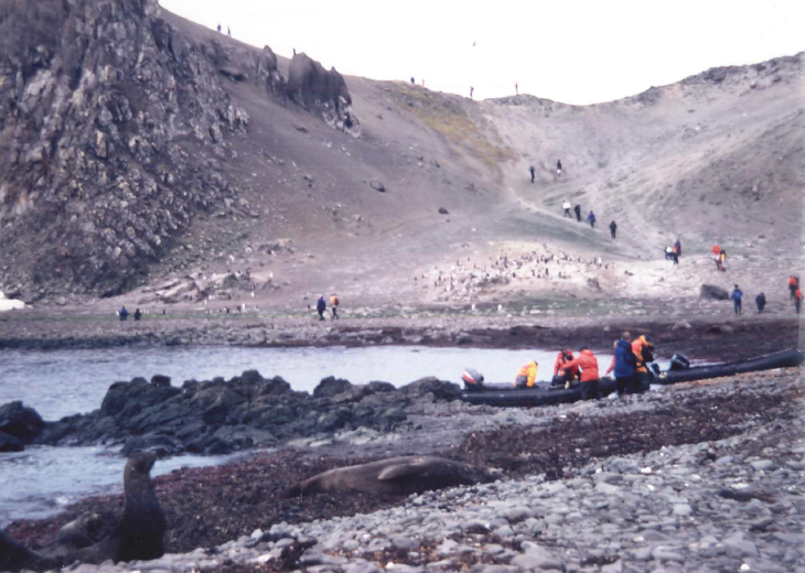
The wildest of the wildlife were the leopard seals and the skuas. A skua is like a seagull on steroids. More than once, I watched a group of 5 or 6 skuas surround a small penguin and rip it apart for food. One unfortunate penguin was alone on a small piece of ice with a leopard seal circling it. None of these scenarios ended well for the penguins. It was a chance to watch the circle of life at its most raw.
Eventually, we headed back to King George Island. The group that set up the course also returned to the ship. At dinner that night, we had a course briefing. The marathon course started and ended at the Uruguayan base, running two loops of a half marathon course. We would start running in one direction, go up a snow hill and turn around, then head back to, and through the Uruguayan base, running another out and back with 10+ miles to go for the first half. That part of the course passed the Russian and Chinese bases along the way. Bart Yasso helped set the course and was really most people’s favorite to win. At dinner that night, Bart was talking like he wasn’t sure if he was running the half of the full, even though the race was the next morning. My strategy was to run with the leader for the first half, and then to pick up the pace and finish with a win.
The next morning was race day. It took some time to get everyone onto the island. The weather wasn’t too bad, and since I train in Reno winters, I felt right at home! The temperature was above freezing, in the high 30s. The race started. From the outset, it was clear that Bart was going to lead. My thought was to push him by staying with him. We ran together. At the half, we were still running together. Bart stopped at the half and won the half marathon. I was by myself, but I knew the course. I had run the first half harder than I had planned to, so I was hurting a little. Bart’s friend Steve caught me at around mile 21 and passed me.
By this time, Bart and the others were on 4-wheelers monitoring the race. At that point, Bart did me a big favor. When Steve passed me I heard Bart say, “There’s our winner”.
I had an Incredible Hulk moment. I didn’t turn green, but adrenaline rushed through me and I told myself that I was not going to lose this race. I knew the remaining miles. There was a gradual climb for about 3 miles, then it leveled off, then there was a steep downhill, with a flat 50 to 100 yards to the finish. My plan was to stay in striking distance behind Steve on the uphill and start an all out attack on the downhill. I was working hard, getting warm, and carrying my gloves and hat. I saw the right turn and knew that after that, it was straight and flat to the finsh. When we got to the right turn, I was still behind Steve, but I was close. I made the right turn and threw the clothes that were in my hands in the air, and sprinted as hard as I could. I ended up barely winning. I love it when a plan comes together. After I caught my breath, Steve and I congratulated each other on a good race, and everyone hung out and cheered the other runners on to the finish line.
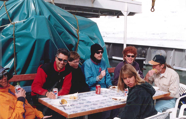
On board the ship that night, I was invited to sit at the Captain’s table for the remainder of the trip. At dinner that night, I formally met the captain for the first time. I said, “Hi, I’m Fred from Reno”. He looked at me and shook my hand. The Captain says, with a heavy Russian accent, “I shot a man in Reno just to watch him die”. At the time, I wasn’t familiar with Jonny Cash, and I thought “That’s weird. Is he threatening me?” Now I know the song lyric, and I totally get it!
During the next couple of days, we toured around Antarctica. We went to Deception Cove. It’s a defunct whaling station and there is warm water, heated geothermally by steam vents from an underwater volcano, where some of our group went swimmimg. It was also interesting when we landed on the actual continent of Antarctica at the Esperanza Argentinan Base. The two day journey back to Ushuaia was much easier than the first crossing. The captain called it, “Drake Lake”. The Drake Passage is only as calm as it was for our second crossing once or twice each year. We were lucky.
It was a great trip. Marathon Tours did an outstanding job. I highly recommend them for any running tours that they do. I’d also like to send a shout out to Bart Yasso. Over the years, he has been very helpful to me personally, and also to the running community as a whole! I wish him happiness in his retirement. To say that the Antarctica Marathon is a unique running experience is an understatement! It’s not a place to run a PR, but it is a race that will challenge you in different ways, from the temperature, to the terrain, to the Drake Passage crossing. It is an excellent way to travel to Antarctica with a purpose, if visiting all seven continents is something you aspire to. It is certainly a race (and a trip) you will never forget!
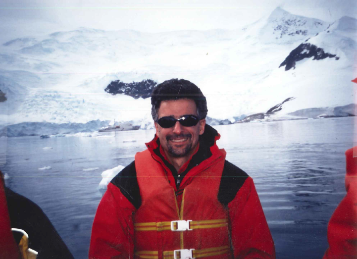
Trip Report